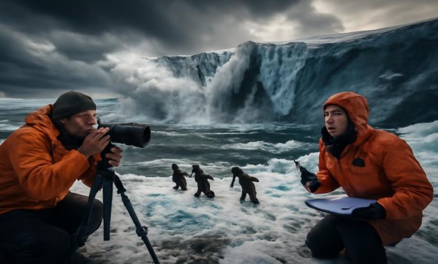
On a gray February dawn that hasn’t arrived yet, you can almost hear it: the stillness before something old and powerful rearranges the sky. The air feels thicker than it should for winter, the clouds move in strange, slow spirals, and every forecast seems to carry a footnote of worry. Deep above our heads, far higher than airplanes fly, something is unraveling in the atmosphere—a quiet shudder in the Arctic that meteorologists say could soon tumble southward and step straight into our daily lives.
When the North Lets Go
For most of the year, the Arctic feels like a separate planet—remote, blue-white, and mythic, connected to us mostly through maps and satellite images. Yet the boundary between “there” and “here” has been getting thinner. What scientists are seeing right now in the upper atmosphere suggests that February may be the month when that boundary ripples, folds, and possibly breaks.
Meteorologists are tracking what they call an “Arctic collapse,” not in the sense that the North Pole disappears, but that the usual cage of cold—the polar vortex—starts to deform, weaken, or even split apart. That cage, ordinarily, keeps the most brutal cold bolted down over the top of the world. When it tilts or fractures, the cold doesn’t politely ask to come south. It lunges.
In control rooms lit by monitor glow, forecasters are staring at maps that look wrong. Wavy bands of color showing pressure and wind at the top of the atmosphere—a region known as the stratosphere—are no longer neat circles. They’re stretched, distorted, like a wheel coming off its axle. The phrase “extreme atmospheric anomalies” sounds clinical on paper, but to meteorologists, it’s the kind of language that makes you sit up and re-run every model you’ve got.
The Polar Vortex You Can’t See
Think of the polar vortex as winter’s invisible crown—a roaring ring of winds about 10 to 30 miles above the Arctic. When it’s strong, it spins fast and tight, sealing cold air inside like water in a bowl. Cities farther south enjoy a relatively tame winter, with the worst of the deep freeze safely locked away.
But this crown isn’t made of metal. It’s more like smoke, easily bent and broken when waves of energy push up from below. These waves can come from huge weather systems, mountain ranges like the Himalayas and Rockies, or even patterns in the Pacific like El Niño. When those waves hit the vortex just right, they can slow it, warp it, and sometimes flip it into chaos.
Forecasters are now seeing signs of that chaos building: unusually strong pulses of warmth in the stratosphere over the Arctic, hints of the vortex weakening, like a top beginning to wobble. This process, called a sudden stratospheric warming, doesn’t feel “sudden” to the rest of us at first. You don’t wake up one day and find the world instantly frozen. Instead, there’s a lag—often a week or two—while the atmosphere slowly transmits its shockwave downward toward the surface.
The Strange Warmth Above the Cold
The eerie part of all this is that an Arctic collapse often begins not with more cold, but with more warmth—at least way up high. While your neighborhood might still be stuck in ordinary gray winter, the air tens of thousands of feet above the pole can heat up by tens of degrees in a matter of days. It’s as if someone lit a candle inside an ice lantern.
Meteorologists watching current data are seeing exactly that kind of anomaly: temperatures in the upper atmosphere that are far above normal, twisting the jet stream into strange new shapes. It’s those shapes that matter. The jet stream—the fast, serpentine river of air that steers storms—is like the nervous system of the weather. When it buckles, weather patterns everywhere twitch.
How a Broken Vortex Visits Your Street
All of this can sound abstract until you imagine it walking down your street. Maybe you live in a quiet suburb where snow is normally a storybook novelty. Or in a city that’s seen winters turning milder and muddier in recent years. This February, that might change with astonishing speed.
As the Arctic’s cold reservoir spills south, it doesn’t just dump air; it reshapes pressure systems, storms, and cloud patterns. One place may suddenly plunge into temperatures more typical of a Siberian outpost. Another might sit under endless gray, where snow melts, freezes, and melts again, turning sidewalks into glass. Farther afield, some regions might paradoxically warm, sitting under a bulge of mild air while their neighbors freeze.
A broken polar vortex is not a tidy event. It’s a re-dealing of the deck, often creating sharp contrasts over small distances. Stand on one side of the line and you’re shoveling shoulder-high drifts. Drive a few hours and the roads are just wet.
What the Models Are Whispering
Weather models aren’t crystal balls, but they are persistent storytellers. When multiple models, run in different ways, start murmuring the same plotline, forecasters listen closely. Over the past few days, many of those simulations have been hinting that the vortex weakening now taking place aloft could cascade down into the troposphere—the part of the atmosphere where clouds form and we live—by early February.
That’s when the Arctic “collapse” would truly arrive in our world. Not everywhere at once, not with perfect symmetry, but in pulses: one region locked in a long-lasting freeze, another hammered by a chain of snowstorms, still another seeing freak cold snaps bite into what had been a harmlessly mild winter. It’s this potential for persistently altered patterns—stuck weather—that worries meteorologists most.
Living With a Lurching Winter
When winter behaves, we build our lives around it almost unconsciously. Communities know when to stock salt, when pipes tend to burst, when roads grow treacherous. Farmers count on a certain rhythm of freeze and thaw. Power companies estimate heating demand based on familiar cold spells.
An Arctic collapse driven by extreme anomalies doesn’t just chill the air; it jumbles the script. Suddenly, emergency managers are eyeing fuel supplies and backup generators. School superintendents are war-gaming strings of snow days. River managers are thinking about ice jams and sudden thaws that could trigger winter flooding. In cities, buses might struggle to start and heating systems that have skated through mild winters could be pushed to their limits.
You feel it on a human level too, in the textures of a day. The breath that hurts just a little when you step outside. The sound of snow squeaking underfoot—the kind of arctic dryness that only comes with true cold. The way your world shrinks for a while to what’s reachable without risking the roads. Even indoors, the air holds a brittle edge that plants, pets, and people all respond to in their own quiet ways.
A Glimpse of the Planet’s Uneasy Future
These episodes aren’t entirely new; history is littered with brutal, unforgettable winters driven by misbehaving polar vortices. But the context around them is changing. The Arctic itself is warming more than twice as fast as the global average. Sea ice is thinner, snow cover patterns are shifting, and the temperature contrasts that drive the jet stream are changing shape.
Some researchers see a troubling interplay here: a warmer Arctic that can both reduce the strength of the polar vortex over time and load the atmosphere with new, unstable energy. The result isn’t a neat picture of “more cold everywhere” but something stranger: increasingly wild swings, with warm spells in deep winter and then, suddenly, knife-edged outbreaks of Arctic air where they don’t “belong.”
In that sense, this potential February Arctic collapse is not an isolated headline but another chapter in a longer story—a climate book where the plot keeps thickening. The familiar patterns are still there, but they feel more prone to lurch, more ready to surprise.
What It May Mean Where You Live
Of course, not every community will feel the Arctic’s hand the same way. While each storm and high-pressure cell will write its own details, the broad possibilities if this collapse unfolds as feared look something like this:
| Region Type | Potential February Impacts |
|---|---|
| Northern inland areas | Prolonged deep freezes, dangerous wind chills, frequent snow events, infrastructure strain. |
| Mid-latitude cities | Sharp temperature swings, ice storms, heavy wet snow, hazardous travel windows. |
| Coastal regions | Rain–snow mix, coastal flooding during storms, strong winds, potential power outages. |
| Traditionally mild winters | Unusual cold snaps, rare snowfall, stress on homes and infrastructure not designed for deep cold. |
| Already dry or drought-prone | Cold but relatively dry conditions, limited snowpack, risk of later water shortages. |
Translate that into daily life and you get furnace filters pushed past their replacement dates, plow trucks running double shifts, neighborhood text threads pinging with “Anyone have a spare space heater?” and “Roads are a sheet of ice—don’t go out.” In some places, winter sports that have felt precarious might suddenly have a brief, frantic revival—thick ice on lakes, powder on slopes—while just a few hundred miles away, rain falls where snow should have been.
Listening to the Warning Without Freezing in Place
There’s a balance to be found in hearing all this. Meteorologists warn because warning is a kind of care: a way of saying, “Look up from the everyday. Something bigger is moving.” But it doesn’t mean panic, or that every nightmare scenario will play out exactly as imagined.
Instead, it invites a kind of alert attentiveness. Dust off the winter kit—gloves that actually keep your fingers warm, a scraper in the car, a blanket and flashlight where you can find them in the dark. Check on the people who always struggle when the temperature plummets: the neighbor with the old car, the friend whose job keeps them outdoors, the elder on the corner whose steps always look a little too icy.
Most of all, it’s a reminder to pay attention to the sky again. To notice how the clouds line up along the wind, whether the air smells like snow, how the trees groan in a hard freeze. In a world that often feels relentlessly digital, this is weather as an ancient, physical force—the same wind and cold that shaped forests, carved mountains, and taught earlier generations how close we really are to the edge of comfort.
What February Might Teach Us
If the Arctic does collapse southward in the coming weeks, the experience will be shared but uneven—messy, inconvenient, sometimes beautiful in its own severe way. Kids may remember the February when snow reached the windowsills, or when everything outside sounded muffled and far away. Utilities crews will remember the calls at 3 a.m., the tangle of frozen pipes and fallen lines. Meteorologists will remember the days they watched the polar vortex lose its grip on the maps and felt, once again, just how alive the atmosphere really is.
And afterward, when the cold retreats and the first softened days of late winter arrive, there will be stories. About the night the power went out and whole apartment buildings glowed with candlelight. About the fox spotted trotting through new snow in the middle of town. About the sound of ice breaking up on a river, like distant thunder.
In those stories, you can hear something larger humming in the background: the awareness that our climate is not a fixed stage but a moving, shifting actor. The Arctic is no longer a faraway backdrop; it’s part of the same room, its moods spilling into ours more often and more strangely than we once imagined.
So as February approaches, with its possibility of an Arctic collapse driven by those extreme anomalies high above, the invitation is simple: prepare, pay attention, and remember that this thin envelope of air around our planet is wild, connected, and very much awake. Each blast of wind, each flake of snow, each puzzling warm day in the middle of a freeze is part of a vast conversation between pole and equator, ocean and land, present and future.
You don’t need a satellite feed to be part of that conversation. Just a window, a little time, and a willingness to step outside long enough to feel what the sky is trying to say.
Frequently Asked Questions
What do meteorologists mean by an “Arctic collapse”?
An “Arctic collapse” refers to a breakdown or major weakening of the polar vortex—the ring of strong winds that usually keeps the coldest Arctic air contained near the pole. When it weakens or splits, that cold air can spill southward, bringing extreme winter weather to regions that are normally more moderate.
Is this the same thing as a polar vortex event?
Yes, they’re closely related. A polar vortex event typically describes when the weakened or disrupted vortex allows frigid Arctic air to surge south. “Arctic collapse” is a more descriptive way of talking about that same breakdown of the usual cold-air containment over the pole.
Will everyone experience severe cold if this happens?
No. The impacts are uneven. Some regions may see intense, prolonged cold and heavy snow, while others end up on the warmer side of the jet stream and experience milder conditions or more rain than snow. The exact pattern depends on how the jet stream reorganizes once the vortex is disturbed.
How far in advance can meteorologists predict an Arctic collapse?
Signs of a potential collapse in the stratosphere can often be detected one to three weeks ahead. However, translating that signal into precise surface weather—who gets the worst cold, when, and how long it lasts—is more difficult and becomes clearer only within a 5–10 day window.
Is climate change making these events more common?
Research is ongoing, but many scientists see links between a rapidly warming Arctic, changing sea ice and snow patterns, and an atmosphere that’s more prone to large swings and disruptions. While not every cold outbreak is “caused” by climate change, the background conditions that shape these events are shifting in ways that can favor more erratic winter behavior.
What can individuals do to prepare for a potential Arctic outbreak?
Simple steps help: ensure your home is weather-sealed, check heating systems, stock basic supplies (food, water, medications, batteries), prepare an emergency car kit, and make a plan to check on vulnerable neighbors or family members during extreme cold. Staying informed through reliable local forecasts is also key.
Why does a warming Arctic sometimes lead to colder winters in some places?
As the Arctic warms faster than mid-latitudes, it can weaken the temperature gradient that helps keep the jet stream strong and straight. A weaker jet stream is more likely to become wavy, allowing pockets of cold Arctic air to spill south while warm air pushes north elsewhere. The result isn’t a colder planet overall, but more dramatic regional contrasts and surprises.