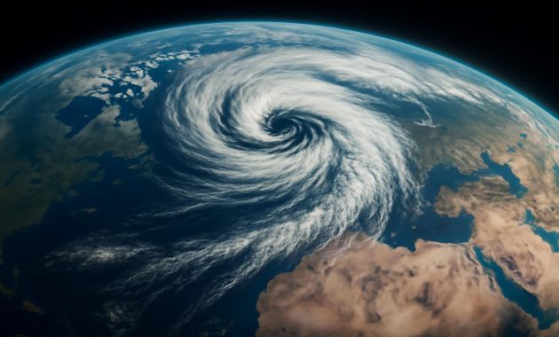
The first sign is the sound. Not the roar of wind or the rattle of ice, but a strange, muffled quiet—like the world has paused to take a breath. Somewhere high above the clouds, forty kilometers over your head, the atmosphere is beginning to twist and warm in ways it rarely does in February. The vortex of icy air that normally spins like a perfectly balanced top over the Arctic is starting to wobble. And that wobble, almost unheard of for this time of year, is about to send a shiver down the spine of half the planet.
The Winter Engine That Never Sleeps
If you could peel back the sky layer by layer, the polar vortex would sit above you like an invisible crown of wind. It isn’t a single storm, or a blizzard, or a swirling cartoon spiral the way weather maps sometimes suggest. Instead, it’s a vast ring of frigid, fast-moving air spinning counterclockwise around the Arctic, high in the stratosphere, about as far above your head as five Mount Everests stacked end to end.
For most winters, that spinning ring behaves a bit like a disciplined, clockwork machine. It helps keep the bitterest cold air bottled up close to the North Pole, corralling it much like the rim of a bowl holds water. As the Sun arcs low on the horizon over polar ice, the darkness and intense cooling reinforce that circulation. The colder it gets, the tighter the vortex spins. Planes cruise far below it; storms rage in the troposphere beneath. But the vortex just keeps whirling, a silent winter engine you never see, yet feel every time Arctic air decides to spill south.
Usually, when you hear about “polar vortex” events, it’s in the dead of winter—December or early January—when brutally cold air plunges into North America or Eurasia. The phrase has become a kind of shorthand for any miserable cold snap, even though the real story is more subtle. Still, there is a link: when that stratospheric engine falters, the weather patterns beneath it begin to loosen and warp like a tent shaken in the wind.
This year, though, something different is brewing. Atmospheric scientists are watching the vortex not just weaken, but undergo what’s called a “major disruption” or sudden stratospheric warming—an explosive event that sends shockwaves through the jet stream. And the timing—deep into February—is what makes this one so remarkable.
A Sudden Warming in a Frozen Sky
It sounds like a contradiction: the air over the Arctic, in the middle of winter, suddenly warming—by tens of degrees—in a matter of days. Yet that is precisely what a sudden stratospheric warming looks like. Imagine the vortex as a spinning dancer, arms tucked in, turning fast. Now picture a rogue shove from the side, a giant atmospheric nudge from waves of air rising up from below, rippling off mountain ranges, land–sea contrasts, and vast storm systems.
Those waves crash into the vortex, stealing its momentum. The dancer opens her arms and slows dramatically; the vortex expands, weakens, and can even split into two or more swirling fragments. As it decays, the air above the pole rapidly warms—sometimes by 30, even 50 degrees Celsius in less than a week. It’s still frigid by human standards, but in the rarefied stratosphere, that abrupt shift is seismic.
Down at ground level, you don’t feel that warmth. You feel the consequences of a broken ring. The once-contained Arctic cold is no longer pinned atop the planet. It oozes outward, sinking into the mid-latitudes in chaotic tongues and lobes of icy air. Places that had been basking in relative midwinter calm suddenly find themselves under siege by biting wind and snow. Others, paradoxically, turn milder than usual as the jet stream buckles and wavers.
All of this is expected behavior in January, when the polar night is deepest and the vortex is usually at its strongest. But this year, as the days are lengthening and the Sun is creeping higher, the atmosphere is rewriting its usual script. The scale of the coming disruption—intense, sprawling, and late—is almost unheard of for February.
Why This February Disruption Stands Out
In the quiet glow of a late-winter afternoon, when icicles drip and the snowpack begins its slow surrender, the planet is usually starting to relax out of peak winter mode. The stratospheric vortex, though still present, is often beginning its seasonal decline. Major disruptions do happen in February—but they are less common, and especially large ones are rare enough that scientists pay close attention.
Meteorologists pore over ensembles of weather models like detectives sifting clues. In the simulations, the vortex doesn’t just weaken. It fractures. It stretches and splits, pushed off-center from the pole, shards of icy circulation peeling away toward Eurasia and North America. The warm anomaly that blooms over the Arctic stratosphere is vast, like a hot-air balloon swelling in the middle of the polar night.
What makes this episode stand out isn’t only the timing, but the way multiple ingredients have lined up: persistent wave activity rising from the troposphere, lingering autumn and early-winter anomalies in snow cover and sea ice, and the broader backdrop of a warming climate and an El Niño-tilted Pacific. One disruption doesn’t prove a trend, but it slides another bead onto a string of unusual polar winters stretching back over the last two decades.
To get a sense of just how unusual this is, consider how a “typical” winter compares to a winter marked by a major polar vortex event:
| Feature | Typical Midwinter | Major Vortex Disruption (Like This One) |
|---|---|---|
| Vortex Strength | Strong, circular, centered over the pole | Weakened, distorted, sometimes split in two |
| Stratospheric Temperatures | Extremely cold and stable | Rapid warming by tens of degrees over the pole |
| Jet Stream Shape | Relatively zonal, flowing west-to-east | Highly wavy, with large north–south swings |
| Cold Air Outbreaks | Short-lived, localized cold spells | Broader, more persistent cold waves in mid-latitudes |
| Timing | Often strongest in December–early January | Deep into February, when disruption is rarer |
It doesn’t guarantee a blockbuster winter storm where you live. But it does mean the dice have been reshaped, loaded in favor of extremes—whether that’s intense snow, sharp freezes, or, in some regions, startling thaws.
How a Broken Vortex Touches Your Street
It’s tempting to imagine the polar vortex as some distant, exotic creature circling the pole, but its moods filter quietly into your daily routines. You feel it when you scrape a windshield hardened into opaque white glass, when your breath curls like smoke in front of your face, when the forecast suddenly speaks in words like “plunge,” “outbreak,” or “dangerously cold.”
When a disruption like this propagates downward, it rearranges the chess pieces of the atmosphere. The jet stream, that muscular river of high-altitude wind that steers storms, begins to kink and loop. In some places, it dives south, dragging frigid Arctic air with it. In others, it arches north, inviting subtropical warmth to invade.
If you stand outside on a night shaped by one of those southward dips, you might notice the way sound carries farther over snow, how the stars seem painfully sharp in air so crisp it almost squeaks in your lungs. Your eyelashes bead with tiny crystals. The world feels pared down to the essentials: breath, heartbeat, the crunch of boots on frozen ground. The cold, in those moments, is the direct echo of a vortex that has lost its balance far overhead.
Elsewhere, the same disruption might mean heavy, wet snow slamming into a city that has coasted through much of winter, or freezing rain lacing across branches and power lines. It might mean a stubborn dome of cold that refuses to budge for weeks, or sudden swings from deep freeze to unseasonable warmth that leave roads heaving with potholes and trees confused about when to bud.
Weather services will talk in the language of probabilities and ensemble spreads. But to you, the outcomes feel like abrupt changes in the story your season has been telling—an unexpected plot twist written in isobars and temperature gradients.
Reading the Signs Without Losing the Plot
There’s a danger, in the age of scrolling headlines, that “polar vortex disruption” becomes just another alarm bell among many. It flashes past on your phone: a swirl of purple and blue on a map, a phrase that sounds vaguely apocalyptic. Yet understanding the scale of what is happening doesn’t require a degree in atmospheric physics. It requires slowing down, tracing the threads between the sky you can’t see and the weather you can feel.
First, timing matters. A major February disruption invites winter to overstay its welcome. The impacts often unfold with a delay—a week, two weeks, sometimes more—like the aftershock of a distant quake. Cold spells that might have faded by late month can be rejuvenated. Spring may feel tantalizingly close, only to retreat behind a curtain of snow.
Second, geography matters. Not every region will freeze. Some may find themselves on the mild side of a wildly kinked jet stream, basking under blue skies while neighboring regions shiver. Europe might trade places with North America in the cold lottery, or Siberia might commandeer the deepest chill. The disruption increases the odds of extremes, but the exact dice roll is still unfolding day by day.
Third, scale matters. This isn’t a local storm system you can simply outrun by driving a few hundred miles. It’s a planetary reorganization of air currents stretching from the ground to the edge of space. The fact that such a large-scale disruption is unfolding this late in winter is what has seasoned forecasters leaning forward in their chairs.
All of which raises a more unsettling question that lingers behind the daily updates and model runs: is this simply another rare, wild swing in Earth’s naturally capricious winter behavior—or is it part of a deeper shift?
The Arctic, Unmoored
To understand why this disruption resonates beyond a single season, you have to look north—far north, to the Arctic, where the climate has been warming more than twice as fast as the global average. Sea ice shrinks and thins, exposing darker ocean water that soaks up more sunlight. Snow cover patterns change. The once-simple gradient between a frigid pole and a milder mid-latitude band has been blurring, like colors bleeding into each other on wet paper.
Some researchers suspect that this “Arctic amplification” is tugging on the threads that bind the polar vortex and jet stream, making them wobblier, more prone to big excursions. Others argue the evidence is still mixed, that long-term data doesn’t yet draw a clean line from melting ice to every cold snap in Boston or Berlin. What is clear is that the background on which every winter plays out is shifting: warmer oceans, altered storm tracks, a stratosphere nudged by greenhouse gases and, occasionally, by volcanic eruptions or tropical cycles.
Within that shifting background, a February disruption of this scale feels like both a reminder and a question mark. The reminder: our climate system is a web, and a tug at one corner—Arctic warmth, tropical storms, Pacific temperature anomalies—can vibrate across continents. The question mark: will events like this become more frequent, or more intense, as the century unfolds? Or will they remain rare but dramatic punctuation marks in the story of winter?
Standing outside on a wind-stunned evening, it’s hard to hold the entire planet in your head. You feel only the sharpness of the cold on your skin, or the dissonance of rain falling where snow should be. But high above you, the atmosphere is grappling with forces both ancient and new, trying to find a new kind of balance in a warming world.
Living With a Wild Winter Future
As the models continue to sharpen their view of this approaching disruption, your own role isn’t to parse contour plots but to decide what to do with the knowledge that the sky is in flux. On a practical level, the advice from forecasters will sound familiar: pay attention to local alerts, prepare for potential cold waves or storms, expect volatility rather than steady, gradual change. Make sure vulnerable neighbors have what they need if the temperature nosedives. Charge the batteries, restock the pantry, find the missing glove.
But there’s another, quieter response available too: to notice. To watch the way the season bends under the weight of such a large atmospheric shift. To step outside and feel how the air changes from day to day, how the wind carries different scents—woodsmoke, wet earth, metallic frost. To see how birds alter their routines, how ice forms and retreats along a riverbank, how the soundscape of your neighborhood changes under snow or thaw.
We live in a time when planetary processes once hidden in technical journals now splash across our screens in real time. A polar vortex disruption in the stratosphere can trend on social media before its consequences have even reached the ground. It’s easy to meet that with dread, or with numbness. But it can also be met with a kind of informed awe: this is the atmosphere breathing in giant, intricate patterns, some older than our species, some newly bent by the signals we’ve sent into the sky.
In a few weeks, perhaps, you’ll stand under a late-winter sun as it glints off crusted snow or puddles of meltwater and feel the hints of the next season assembling themselves. The vortex will spin down as spring gains strength. Birds will push north. Buds will swell. But in the quiet shift between seasons, you might remember that far above you, in the rarified cold where the air first began to wobble and warm, this February wrote an unusual chapter—one where the winter engine faltered at a time it usually hums along, and the world, for a moment, felt the tremor.
Frequently Asked Questions
What exactly is the polar vortex?
The polar vortex is a large-scale circulation of cold, fast-moving air that forms over the Arctic (and a similar one over the Antarctic) high in the stratosphere during winter. It acts like a spinning barrier that usually keeps the coldest air near the poles.
How is a polar vortex disruption different from a normal cold snap?
A typical cold snap is driven by short-term shifts in the jet stream and local weather patterns. A polar vortex disruption starts much higher in the atmosphere and can reshape large-scale wind patterns for weeks, increasing the chances of prolonged or widespread cold outbreaks.
Why is a February disruption so unusual?
Major disruptions are more common earlier in winter, when the vortex is strongest. By February, the vortex is often already weakening naturally. A large, late-season disruption suggests especially strong atmospheric wave activity and is relatively rare in the historical record.
Will this mean extreme cold where I live?
Not necessarily. A disrupted vortex increases the risk of extremes, but the exact outcome depends on how the jet stream responds. Some regions may see severe cold or heavy snow, while others might experience milder-than-normal conditions. Local forecasts remain the best guide.
Is climate change causing these polar vortex events?
Scientists are still debating the exact relationship. There is evidence that Arctic warming may influence the jet stream and the stability of the polar vortex, but the connection is complex and not yet fully settled. What is clear is that these events are now unfolding against a warmer global backdrop, which can shape their impacts.