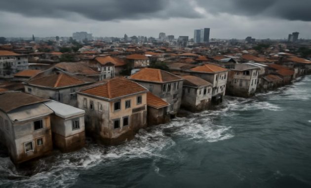
The first time you walk along a coast that is quietly drowning, nothing looks particularly dramatic. The sea still folds in and out with its familiar breath, gulls still circle, and children still run along the wet sand. Only when someone points it out—the missing dune, the drowned tree stumps, the churchyard wall now flirting uneasily with the tide—does the story shift. You realize you’re standing in a place where the land itself is sinking, where the ground beneath your feet is sliding, slumping, and subsiding faster than the oceans are rising. The sea, in many of these places, is not so much invading as it is simply staying where it is while the land bows down to meet it.
The Silent Drop: When Ground Becomes a Slow-Motion Wave
Sea-level rise is an easy villain to picture. It’s the swelling blue line on a graph, the images of storm-battered beaches, the words “melting ice caps” repeated until they bleed into background noise. But in some of the world’s most vulnerable regions, the water is not the only thing moving. The ground itself is sinking—sometimes by centimeters a year—while local seas climb by only a few millimeters.
This settling of the Earth’s surface is called land subsidence. It sounds benign, like a cake gently deflating in an oven. In reality, it’s the slow crumpling of the foundations of cities, deltas, and entire coastlines. Humans, ever inventive, have managed to speed it up by pumping water, oil, and gas from beneath the surface, by loading cities onto soft sediments, by damming rivers that once delivered replenishing sediment to the sea’s edge.
From space, satellite measurements now catch the minute sagging of these landscapes. On the ground, the changes show up in more visceral ways: doors that no longer close, streets that flood on cloudless days, fishers tying their boats to what used to be front steps. In these places, climate change is not arriving on the horizon—it is coming from above and below at the same time.
Delta Cities on Their Knees
Most of the fastest-sinking places on Earth are built on deltas, those generous, low-lying fans of mud where rivers meet the sea. They’ve drawn humans for thousands of years with their fertile soils and rich fisheries. But the same soft sediments that grow rice and shelter mangroves can also compact, squish, and collapse.
In Indonesia, the northern coast of Java tells a story that feels like a warning from the future. In parts of Jakarta, the ground has been sinking by as much as 20–25 centimeters a year. Standing in some neighborhoods, you can feel as though you’re in the hull of a giant ship that’s taking on water, with concrete walls hastily raised as defensive bulkheads. Families who once lived comfortably above the tideline now watch tides washing through their streets, the sea arriving not as a distant storm but as an everyday visitor.
The culprit is not just the weight of the city but the thirst of its people. For decades, groundwater has been pumped from the aquifers beneath Jakarta faster than they can refill, leaving underground voids that settle and compact. It’s like quietly letting the air out of a mattress that millions of people are standing on. While the global ocean creeps up by 3 to 4 millimeters per year, parts of the city are dropping tens of times faster. The relative sea level—the sea compared to the land—is therefore rising at a terrifying pace.
Jakarta is not alone. Across the South and Southeast Asian coasts, delta megacities face the same double squeeze. In Bangkok, built on what was once swampland, buildings tilt, streets buckle, and some parts of the city sink more than a centimeter a year. In Ho Chi Minh City, Vietnam, whole districts have dropped enough that routine high tides reach neighborhoods that never used to flood. In the sprawling Ganges-Brahmaputra-Meghna Delta, where Bangladesh meets the Bay of Bengal, villagers mark the years by which fruit trees have drowned and which fields now taste too salty to grow rice.
To capture this uncomfortable arithmetic of land versus sea, it helps to see the numbers side by side.
| Region / City | Average Land Subsidence (per year) |
Local Sea-Level Rise (per year) |
Key Driver |
|---|---|---|---|
| Jakarta, Indonesia | Up to ~200–250 mm in hotspots | ~4–6 mm | Groundwater extraction, soft delta sediments |
| Bangkok, Thailand | ~10–30 mm | ~3–4 mm | Groundwater extraction, urban load |
| Ho Chi Minh City, Vietnam | ~10–40 mm (varies by district) | ~3–5 mm | Groundwater use, sediment compaction |
| Mississippi Delta, USA | ~5–15 mm | ~3–4 mm | Sediment starvation, oil & gas extraction |
| Nile Delta, Egypt | ~4–8 mm | ~3–4 mm | Sediment trapping by dams, natural compaction |
Each row in that table is a quiet alarm bell. In all of them, the land is sinking as fast—or much faster—than the sea is rising. In human terms, it means that sea-level projections based only on global climate models are underestimations for millions of people. The ground they stand on is not a stable reference point; it is part of the moving problem.
Coasts That Crumble: From Louisiana Marshes to the Nile Delta
If river deltas are shaped like open hands reaching into the sea, then the Mississippi River Delta in Louisiana is a palm whose fingers are being slowly gnawed away. Flying over coastal Louisiana, you can see the evidence of this erosion etched into the landscape: ragged patchworks of open water where maps still show solid ground, sunken forests known as “ghost swamps,” their trunks bleached and dead in brackish water.
Here, land subsidence is a layered story. The Gulf Coast is naturally prone to sinking as the weight of accumulated sediments presses down on deeper layers. But the pace has been accelerated by human meddling. Levees built along the Mississippi River to prevent flooding and support shipping have had an unintended side effect: they trap precious sediment inside the river channel instead of letting it spill out across the delta to build new land. At the same time, oil and gas extraction from below the delta has contributed to further subsidence in many areas.
As the land sags and the supply of new sediment dwindles, saltwater pushes further inland. Communities that once sat comfortably behind tangles of marsh and cypress now find themselves directly exposed to storms. Every hurricane has more open water to whip into waves, more unanchored land to tear apart. From the vantage point of a fisherman navigating a maze of channels where his grandparents walked to school, it feels less like the sea is rising and more like the Earth is melting out from underneath him.
On the far side of the Atlantic, in Egypt’s Nile Delta, another great river mouth is slowly submerging. The construction of the Aswan High Dam in the 20th century drastically reduced the sediment that once flowed to the delta. Without that annual gift of silt, the soft ground has been compacting and settling. Farmers watch as saltwater creeps inland, turning rich alluvial fields patchy and white with crystals. Protective sea walls have been thrown up in places, but they only defend for a time; the land behind them keeps dropping, like someone quietly unscrewing the floor jack under a house.
The paradox of these coasts is cruel. They are some of the most productive, densely populated, and culturally rich regions in the world, and also among the most fragile. Subsidence and sea-level rise conspire to undermine not only buildings and roads but entire ways of life built around soil, fresh water, and a particular interface between land and sea.
Invisible Mechanics: Why the Earth Sinks Underfoot
Land subsidence can feel like a mysterious fate, but its mechanics are, in many places, surprisingly mundane. Imagine a saturated sponge holding up a layer of sand and concrete. Now start pulling the water out of that sponge, fast. The sponge shrivels, the sand settles, and the concrete slabs on top begin to crack and tilt. That, in essence, is what happens when cities mine groundwater from deep aquifers faster than rain and rivers can refill them.
In coastal China, in cities like Tianjin and Shanghai, decades of intense pumping once caused parts of the land to plunge by meters. Restrictions on groundwater extraction and a shift to surface water sources have slowed the rate in some districts, demonstrating that the process, while stubborn, can be nudged in the right direction. But much of the damage is irreversible: once sediments compact and grains lock more tightly together, the land cannot simply spring back when the water returns.
Other forms of extraction leave their own fingerprint. In the Mississippi Delta and parts of the North Sea coast, withdrawing oil and gas from underground reservoirs has contributed to slow-motion sagging. The removal of these fluids from pore spaces allows overlying rock to settle downward, transferring that vertical movement all the way to the surface.
Then there is the weight of our own ambitions. Gigantic skyscrapers, elevated highways, airports reclaimed from the sea—all of them add load to soft, unconsolidated ground. Over time, those sediments breathe out the water and air between their grains and compact further.
Even ancient ice can play a role. In places like Scandinavia and parts of Canada, the land is still rebounding upward after being compressed under the weight of ice sheets that vanished thousands of years ago. In other regions, the redistribution of water across the Earth as ice melts and oceans swell causes subtle shifts in the planet’s crust. It’s a complex, interconnected choreography: water moves, rock moves, soil moves, cities move—even if we rarely notice, until the high-tide line sneaks into our kitchens.
Lives on the Edge: Human Stories from Sinking Shores
Statistics about millimeters per year can feel abstract until you are the one stacking sandbags in front of your door on a sunny day. In the outskirts of Manila, residents living along low-lying estuaries describe “high-tide floods” that visit like an extra monsoon. No rain, no storm, just water quietly pushing up through drains and over riverbanks because the land has dropped and the sea has not.
In a village along the coast of Bangladesh, an elderly farmer points to a line of toppled date palms out in the shallow surf. “That was the border of our land,” he says. “I played football around those trees.” Now, the family lives in a smaller, salt-stung plot further inland. They have raised their home on an earthen plinth, a modest hillock of hope against the next cyclone and the next few millimeters of relative sea-level rise.
Far away, in a Venetian alley that smells of stone and brine, a shopkeeper has penciled the dates of acqua alta—the high-water floods—onto a doorframe. The lines are climbing. Venice is not subsiding as dramatically as some delta megacities anymore, but centuries of building on unstable sediments, combined with regional subsidence and global sea-level rise, have made floods more frequent. The city’s famous plazas and churches now live in tense negotiation with the tides.
For many coastal residents, the choices are stark and deeply personal. Do you invest in raising your house, knowing the road may flood next? Do you plant rice this year, or shift to shrimp that tolerate saltier water but come with new risks? Do young people stay and gamble that new defenses, pumps, and policies will hold, or do they join the slow migration inland, away from the home their grandparents knew?
All of these stories share something in common: the sense that the baseline has changed. The old rules about where water belongs no longer apply. The ground itself, once considered the ultimate stable reference point, has become fluid in its own way.
Holding the Line: Can We Slow the Sinking?
There is no single fix for a problem woven from geology, climate, and human appetite. Yet around the world, cities and nations are beginning to grapple with land subsidence not as a background curiosity but as a central challenge of coastal survival.
The most immediate lever is often water. By regulating groundwater extraction—switching to surface water where possible, improving efficiency, and investing in rainwater capture—authorities can slow or stabilize subsidence in some regions. Tokyo, for example, once suffered significant land subsidence due to groundwater pumping, but strict regulations introduced in the mid-20th century drastically reduced the rate of sinking. It remains a powerful example of what is possible when policy takes the physics of the ground seriously.
Engineering has its role too, though it comes with trade-offs. Sea walls, levees, storm-surge barriers, and giant pumps can protect valuable districts but sometimes worsen flooding elsewhere or cut off the natural movement of sediment. “Soft” approaches—restoring wetlands, allowing rivers to meander and spread sediment, replanting mangroves—aim to work with natural processes to build resilience. In Louisiana, ambitious plans now seek to reconnect the Mississippi River with some of its starving wetlands via controlled sediment diversions, letting muddy water once again fan out and create land.
Some communities are exploring more radical options: managed retreat from the most vulnerable zones, raising entire neighborhoods on higher foundations, or designing amphibious architecture that can float during floods. In each case, the question is the same: where do we draw the line, literally and figuratively, between land and sea, and how much are we willing to invest—financially, emotionally, culturally—to hold that line for another generation?
Ultimately, slowing the sinking also means addressing climate change itself. Even if we perfectly controlled groundwater pumping and restored every wetland, unmitigated global warming would continue to raise ocean levels for centuries. Reducing greenhouse gas emissions, therefore, is not a separate battle but part of the same one. The more we limit global sea-level rise, the more room we have to deal with the land’s own movements.
A New Map of the Shoreline
When future generations look at maps of our time, they may see the current coastlines as we now see ancient shorelines traced on rock—temporary, contingent, already on their way to becoming something else. For people living in key regions where the land is sinking faster than the sea is rising, that transformation is not a distant curiosity. It is an everyday negotiation with tides, rain, salt, and soil.
In the crack of a subsiding wall or the ghost of a drowned forest, there is a reminder that the Earth is not static beneath us. We have built our cities on river mud and swamp, on reclaimed seabeds and compacting sediments, and then drawn bold lines on maps as if they would last forever. Now, the combined pressure of our own engineering and a warming climate is revealing just how provisional those lines really are.
Walking that drowning coast again, you might notice different things. The tide gauge half-buried in barnacles. The concrete house propped up on a new ring of bricks. The old man pointing to a square of water where his childhood soccer field used to be. You might realize that “sea-level rise” is not just the ocean swelling upward but also the ground bowing, collapsing, and slipping away.
Between the sinking land and the rising sea is a thin, shifting strip of hope and decision. How we read that strip—how we measure it, honor it, and adapt to it—will shape the stories future generations tell about these coasts. Perhaps they will talk not only about the water that rose, but about how, finally, we learned to listen to the land as it moved under our feet.
Frequently Asked Questions
What is land subsidence?
Land subsidence is the gradual or sudden sinking of the Earth’s surface. It can be caused by natural processes, like the compaction of sediments, or by human activities such as excessive groundwater, oil, or gas extraction, and the heavy loading of cities on soft ground.
How is land subsidence different from sea-level rise?
Sea-level rise refers to the increase in the height of the world’s oceans, mainly due to melting ice and the expansion of warmer water. Land subsidence is the sinking of the ground itself. In many coastal areas, both happen together, making relative sea-level rise—the change between land and sea—even faster.
Why are river deltas especially vulnerable?
River deltas are built from soft sediments deposited by rivers. These sediments naturally compact over time. When humans dam rivers, pump groundwater, or build heavy cities on these sediments, the compaction speeds up, causing faster subsidence. Because deltas are low-lying, even small changes in elevation can lead to flooding and saltwater intrusion.
Can we stop land from sinking?
In many cases we cannot reverse subsidence that has already happened, but we can often slow or stabilize it. Reducing groundwater extraction, managing oil and gas production carefully, and restoring natural sediment flows can all help. Some cities, like Tokyo, have dramatically reduced subsidence through strict groundwater regulations.
How does land subsidence affect everyday life in coastal areas?
Subsidence can lead to more frequent and severe flooding, even during normal high tides. It can damage buildings, roads, and drainage systems, increase saltwater intrusion into farmland and drinking water, and raise the costs of infrastructure maintenance. For many communities, it means tougher choices about where and how to live, farm, and build for the future.