The ship’s hull whispered as it slipped through the black, ice-cluttered water. Above, the Southern Ocean was all wind and white fury; below, no light, no color—only cold and pressure. On deck, scientists huddled around glowing screens, watching lines of data crawl upward from the seafloor like signals from another world. For years, they had suspected Antarctica was hiding something beneath its frozen edge. But no one expected this.
There, in the grainy blue of sonar maps, the familiar flatness of the continental shelf fell away into jagged gashes—deep, shadowed scars that cut across the seabed for hundreds of kilometers. One canyon appeared, then another, and another, until the screen looked less like a smooth underwater plain and more like a vast, secret mountain range turned inside out. Hundreds of submarine canyons, carved into the margins of Antarctica, had been hiding in the dark all along.
The Night the Seafloor Lit Up
The moment of discovery didn’t arrive with a cinematic chorus, just the quiet tension of tired people staring at a display. The research vessel rolled in the swell as multibeam sonar painted the unseen world below the ice. These sound waves, fired from the underside of the ship, bounced off the seafloor and returned as data points, slowly building a 3D image of the ocean bottom.
At first, the scientists expected the usual: a gently sloping shelf, a few ridges, a scattering of bumps and depressions. That’s what decades of coarse maps and sparse ship tracks had led them to believe. But as the ship traced careful lines along the Antarctic margin, the seafloor refused to stay simple. It dropped away in sheer walls. It folded and curled. It sliced into the continent in narrow chasms that were, in some places, deeper than the Grand Canyon.
Someone leaned closer to the screen, then called another researcher over. Soon, the small dark lab was full of murmurs, fingers pointing, rough sketches drawn on scrap paper. What they were seeing was not a fluke. It was a pattern—a repeating network of canyons incised into the seafloor wherever ice, ocean, and land met. The Antarctic continental margin, they realized, was not a blunt, icy rim. It was a labyrinth.
The Hidden Architecture of an Icy World
Submarine canyons are not new to science. They cut through the edges of continents all over the world, from the California coast to the Bay of Bengal. Often they begin near the mouths of rivers and plunge seaward, channels that once guided sediment flows and undersea avalanches down the continental slope.
But Antarctica is different. Here, rivers are not the main sculptors. Ice is. Glaciers grind their way across the continent, carrying rock, dust, and frozen memories of ancient climates. At the coast, these glaciers spill into the ocean as floating ice shelves—vast, flat plates of ice that extend like frozen tongues over deep water. Beneath them, warm, salty water creeps in at depth, licking at their underside, thinning them from below in a process known as basal melting.
The newly mapped canyons appear to be the highways that water uses to reach this ice. Deep, narrow channels funnel slightly warmer, denser water from the open ocean toward the grounding lines—the invisible edges where ice shelves first lose contact with the land and begin to float. These canyons are not just scars; they are arteries.
In the quiet of the Antarctic night, as the ship slowly traced its path, the data began to suggest a story: over thousands or even millions of years, ice sheets and ocean currents had carved these channels together. Glaciers, heavy and relentless, pushed the seafloor down, gouging troughs that extended out onto the continental shelf. Later, as sea levels rose and fell and ocean circulation shifted, dense currents scoured those troughs deeper, sharpening them into canyons and linking them to the deep ocean beyond.
What the Canyons Look Like
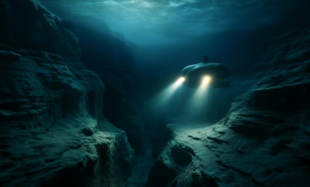
On the screen, the canyons are coded in color—shallows in yellow and green, depths in cobalt and violet. In reality, if you could dive down, you’d see something closer to a drowned mountain valley: steep, often nearly vertical walls, ledges and terraces, occasional mounds of debris where ancient flows of mud and sediment came to rest. The water would be ink-dark, clear but starless. There would be no sound except the faint hiss of your own equipment and the distant, muffled rumble of shifting ice.
Some canyons are short and steep, knifing abruptly from the shelf down the slope. Others stretch inland beneath the ice shelves like submerged fjords, tracing the pathways where outlet glaciers once flowed when sea level was lower and the ice margin sat farther out. A few are braided and branching, a network of channels that meet and part again, as if the seafloor had once hosted an underwater river system.
Rewriting the Map of the Southern Ocean
When scientists say these discoveries “rewrite what we thought we knew,” they aren’t being poetic; they mean it in the most literal sense. Global ocean models—those powerful, number-crunching tools used to predict everything from fisheries productivity to sea-level rise—depend heavily on maps of seafloor topography called bathymetry. For many parts of Antarctica, that bathymetry was, until recently, little more than guesswork.
Now, those guesses are being replaced with high-resolution reality. And the difference is dramatic. Where models once assumed a smooth, gently dipping shelf, they must now contend with deep, cross-cutting canyons that change the way water can move.
Ocean water is not a uniform mass. It is layered by temperature and salinity—warm, salty water below; colder, fresher water above. These layers behave like fluids of slightly different weights, sliding past each other, mixing along boundaries, sometimes spilling over hidden sills and through narrow channels. A canyon can act like a funnel, focusing deep water into a narrow path and increasing its speed. Or it can serve as a trap, an eddy nursery where swirling currents spin off and hold onto heat or nutrients much longer than the open ocean would.
In the Antarctic, one particular variety of water is of special interest: Circumpolar Deep Water, which, despite its name, is relatively warm—just a few degrees above freezing, but warm enough to melt ice efficiently. These newly mapped canyons provide pathways for this deep water to approach and undercut glaciers from below. Where the canyons intersect the grounding lines of major ice streams, they form hotspots of basal melting.
How the Canyons Change the Story
Without these features in models, scientists may have underestimated how quickly warm water can reach vulnerable parts of the ice sheet. Or, in other cases, they may have overestimated it—because not every canyon is a highway; some are cul-de-sacs, their geometry and local currents preventing warm water from penetrating all the way to the ice.
The new maps reveal a much more intricate landscape of risk and resilience. Two glaciers sitting side by side along the same coast may face very different futures simply because one has a deep, open canyon at its grounding line and the other is shielded by a shallow sill or a blocked channel. What had once seemed like a smooth, continuous ice margin is now a jagged series of individual stories, each shaped by unseen architecture beneath the waves.
Life in the Long, Cold Shadows
At first glance, these canyons might seem like inert geology—grand but lifeless. Yet everywhere oceanographers look, canyon ecosystems defy that assumption. Submarine canyons in other parts of the world are often biological hotspots, focusing currents that deliver food and nutrients to depths that would otherwise be relatively barren.
Though Antarctica’s new canyons are only just beginning to be explored biologically, past experience offers clues. Down there, in the cold and dark, currents sliding along the canyon walls may carry a steady rain of organic particles—tiny fragments of algae, zooplankton, and detritus that drift down from sunlit waters. Sponges, corals, and other sessile animals can anchor on rocky outcrops, spreading their filter-feeding arms into the flow. Starfish and brittle stars graze the soft sediments. Strange, slow fish move like shadows along the bottom, their blood rich with antifreeze proteins.
These communities may be fragile, finely tuned to the particular flow patterns and sediment regimes of their canyon home. A slight shift in current strength, temperature, or oxygen can reshape who thrives and who vanishes. When climate change alters the amount of ice overhead, the timing of plankton blooms, or the route that deep waters take, the effects will ripple down into these cold, silent ravines.
Canyons as Climate Archives
Submarine canyons are not only living systems; they are also libraries of the past. Layered within their sediments are stories: of ancient ice advances and retreats, of storms and floods, of shifts in wind patterns that re-routed currents. Every grain of sand and dust has a history.
By drilling cores into canyon floors and walls, scientists can reconstruct how the Antarctic environment changed over hundreds of thousands of years. In some cores, tiny shells of plankton record the temperature and chemistry of the seawater that bathed them when they lived. In others, layers of coarse gravel interspersed with fine mud might mark rapid pulses of sediment dumped from retreating glaciers. These silent records help researchers distinguish between natural climate cycles and the rapid, human-driven changes currently underway.
Recalibrating Our Future Seas
The discovery of hundreds of hidden Antarctic submarine canyons arrives at a tense moment in human history. The oceans are warming. Ice shelves are thinning and, in some cases, shattering. Global sea level is rising, and how fast it will rise depends heavily on what happens in places most of us will never see—cold, dark corners beneath floating ice, where warm water meets ancient ice along fracture lines and grounding zones.
To forecast our future, climate models must be able to simulate how heat is transported around the planet. The newly charted canyons are a missing piece of that puzzle. They shape where and how quickly deep water can creep in beneath the Antarctic ice, which in turn determines how fast ice shelves lose their buttressing grip on the glaciers behind them. Once enough of that support is lost, glaciers can accelerate, pouring more ice into the ocean and pushing sea levels higher.
Updating models with this new seafloor detail is not a simple matter of redrawing a map. It means embedding canyon geometry into equations that govern friction, mixing, and flow. It means revisiting projections that previously assumed a smoother, less channeled world. Preliminary results suggest that in some regions, melt rates may need to be revised upward; in others, the complex topography may slow intrusion of warm water more than expected, offering temporary reprieves.
A New Table of the Unknowns
Even as the maps grow sharper, there is a deep awareness among scientists that vast unknowns remain. Many canyons are still only coarsely sketched, their upper reaches concealed beneath thick ice shelves where ship-based sonar cannot reach. Autonomous vehicles and airborne radar are beginning to fill the gaps, but the picture is still emerging.
Below is a condensed view of how these submarine canyons intersect with our understanding of the Antarctic system:
| Aspect | Role of Submarine Canyons |
|---|---|
| Ocean Circulation | Guide deep, relatively warm waters onto the continental shelf, altering heat delivery to the ice. |
| Ice Shelf Stability | Focus basal melting at grounding lines, potentially destabilizing glaciers and accelerating ice loss. |
| Marine Ecosystems | Create biological hotspots by concentrating nutrients and organic matter in deep, sheltered environments. |
| Climate History | Preserve layered sediment archives that record ancient ice-sheet advances, retreats, and ocean changes. |
| Climate Models | Force revisions in projections of ocean heat transport, ice melt rates, and future sea-level rise. |
Listening to the Quiet Continent
Antarctica often feels like an abstraction: a white smear at the bottom of the map, far from our daily lives. Yet the oceans bind it to us. The currents that swirl around the continent help regulate global climate, storing heat and carbon in their depths. The ice that rests on the Antarctic bedrock holds enough frozen water to raise global sea levels by many tens of meters. And threaded through that ice-ocean interface are these newly revealed canyons—silent architects of how quickly that frozen water might move.
Standing on the deck of an ice-strengthened ship, the connection is almost disorienting. Above, the world is all sky and wind, a vast monochrome of cloud and snow. A petrel glides in the updraft of the ship’s wake, alone against the horizon. Below, unseen yet suddenly vivid in the mind’s eye, lie chasms as deep as city skyscrapers are tall, their walls carved by forces older than human memory.
There is something humbling about realizing that such colossal features remained hidden until now, simply because we had not yet pointed the right instruments into the dark. We have sailed past this continent for centuries, thinking we understood its rough outline. Only now are we beginning to see that beneath the ice and waves, the story is far more intricate—and far more entangled with our own future—than we imagined.
The canyons of Antarctica do not roar or glow. They do not announce themselves. They simply shape the quiet journeys of cold and warmth, salt and fresh, life and sediment, over spans of time that make our lifetimes seem brief. Yet by tracing those journeys—with sonar, with cores, with models—scientists are learning to hear the faint, powerful signals that these hidden landscapes send to the rest of the planet.
In that sense, every new canyon mapped is not just a scientific achievement but a small shift in how we relate to the world. The oceans are no longer just flat blue spaces between continents; they are deep, carved, and alive with structure. Antarctica is no longer a static white mass but a dynamic edge, pulsing with invisible flows. And beneath it all, in the dark, those canyons wait—not empty, but full of meaning, quietly rewriting what we thought we knew about the oceans.
Frequently Asked Questions
What exactly is a submarine canyon?
A submarine canyon is a deep, steep-sided valley cut into the seafloor of a continental margin. It can begin near the coast or under an ice shelf and extend hundreds of kilometers out toward the deep ocean, often resembling an underwater version of a mountain canyon on land.
How did scientists discover so many new canyons under Antarctica?
Researchers used high-resolution bathymetric mapping, mainly with multibeam sonar mounted on research ships and data from autonomous vehicles and aircraft. As more detailed surveys were carried out along the Antarctic margins, they revealed complex, previously unresolved canyon systems beneath and near ice shelves.
Why are these Antarctic canyons important for climate change?
The canyons act as pathways that guide relatively warm deep water toward the base of Antarctic ice shelves. This focused flow can increase basal melting, affecting ice shelf stability, glacier speeds, and ultimately the rate of global sea-level rise. Accurately representing these pathways is crucial for reliable climate and sea-level projections.
Do animals live in these deep Antarctic canyons?
Yes. Although still poorly studied, Antarctic submarine canyons are expected to host diverse life, including sponges, corals, worms, crustaceans, and specialized fish. Canyons often concentrate food and nutrients, creating biological hotspots even in cold, dark environments.
How does this discovery change ocean models?
Many older models used simplified seafloor maps that missed or smoothed out these canyons. Incorporating detailed canyon topography changes how models simulate ocean currents, mixing, and heat transport around Antarctica, leading to revised estimates of ice melt rates and future sea-level rise.