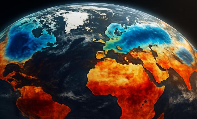
The first sign that something unusual was happening did not come from a blaring headline or a stern government alert. It arrived instead in the quiet way winter often speaks: a strange stillness in the air, the shy hesitation of frost on a windshield, the sense that the sky was holding its breath. In a small office lined with maps and glowing monitors, far from the places that would soon feel the shock, a meteorologist watched a cluster of colors twist and stretch over the top of the world. High above the Arctic, the polar vortex—usually a tidy, frigid whirl of air—was starting to wobble.
The Hidden Engine Above the World
Think of the polar vortex as winter’s invisible engine—a vast ring of screaming-fast winds spinning around the Arctic, about 30 kilometers (18 miles) above our heads in the stratosphere. Most days, most years, you never hear about it, because it does its job quietly. It keeps the hardest, cruelest cold locked near the pole, like a lid on a cauldron of icy air.
But every so often, that engine misfires.
Stratospheric temperatures can suddenly spike by 30–50°C (though still well below freezing), in what scientists call a “sudden stratospheric warming.” It sounds harmless—warmer air, what’s the problem?—but this is where the story flips. When the air high above the pole warms rapidly, the polar vortex can weaken, split, or simply lurch drunkenly off-center. Instead of a neat circle of wind, you get a misshapen, staggered swirl that lets the cold escape.
This is what meteorologists mean when they warn of a “polar vortex disruption.” It’s not that the vortex “comes down” to the surface like some icy monster; it’s that the once-stable ring that kept Arctic air mostly in place breaks down. And when that happens, winter stops playing by the usual rules.
On computer screens in weather centers from Washington to Berlin to Tokyo, those rules are currently being rewritten in bright shades of purple and blue. A major disruption, they’re saying. A wobble strong enough to send frigid air spilling south—again and again—in a series of jolting cold swings that could ripple across multiple continents.
The Tell-Tale Wobble: What Meteorologists Are Seeing
Inside the world’s forecast models, the atmosphere is rehearsing its next act. Some simulations show the vortex stretching like taffy, others predict it will snap into two lobes, one sagging toward North America, another leaning toward Eurasia. None of these outcomes look calm from the ground.
Meteorologists watch a handful of key signals when they suspect the polar vortex is about to misbehave. Among them are:
- Rapid warming in the stratosphere over the Arctic
- Changes in the strength and direction of high-altitude winds
- Large, wavelike patterns in the jet stream rising from lower latitudes
- Shifts in pressure patterns over the North Atlantic and North Pacific
In the past, similar configurations have acted like a trigger. The notorious North American cold wave in 2014, the brutal European cold blast in 2018 often nicknamed “the Beast from the East,” and several severe winters in East Asia have all been linked to disrupted polar vortices.
What’s catching attention now is how synchronized these signals appear. The vortex isn’t just weakening—it’s being buffeted, squeezed, and warped by powerful atmospheric waves rising up from below. That suggests that once it breaks, the consequences might not be localized to a single region. Instead, multiple continents could feel the sting in closely spaced waves of cold, snow, and temperature whiplash.
The Rhythm of Cold Waves
The fallout from a polar vortex disruption doesn’t happen overnight. There is a rough choreography to the chaos. First, the disturbance occurs high above the Arctic, in the stratosphere. Then, over the span of one to three weeks, that disruption “drips” downward into the layers of air that we live in—the troposphere.
During that descent, the jet stream, which usually snakes around the Northern Hemisphere in a relatively stable band, begins to twist and buckle more dramatically. Deep troughs plunge southward, bringing Arctic air to places that expect only mild chills, while ridges of unseasonable warmth push north, melting snow in one region even as another is buried in it.
The pattern can repeat, pulsing like a heartbeat. A cold wave in North America followed by a brief thaw, only for another burst of cold to crash into Europe, then a swing back to Asia. For people on the ground, it feels erratic, even unfair: one week you’re pulling out your heaviest coat, the next you’re standing bewildered in a January drizzle.
Continents in the Crosshairs
When meteorologists warn that this particular disruption could trigger extreme cold swings “across multiple continents,” they’re talking about the broad reach of those jet stream contortions. The exact impact depends on how the vortex breaks—and where its cold lobes end up—but the possibilities are stark.
North America: The Breath of the Arctic
Across the plains of Canada and the United States, the potential is for rapid, punishing intrusions of Arctic air. Temperatures that were running above average could suddenly plunge, in some spots by 15–25°C in just a day or two. Lakes that sat stubbornly unfrozen may lock in a crust of ice overnight. Moisture surging up from the Gulf of Mexico could collide with that bitter air, igniting heavy snowstorms or biting ice events.
Cities like Chicago, Minneapolis, and Toronto know this script, but the timing and severity still catch people off guard. Frostbite times shrink to minutes in the harshest wind chills. Power grids strain under the surge of heating demand. Roads turn to treacherous gray slush that freezes into rutted armor as the night deepens.
Europe: From Rain to Razor-Cold Wind
On the other side of the Atlantic, Europe finds itself perched on the knife-edge of competing air masses. In some years, a disrupted polar vortex has sent relentless easterly winds pouring from Siberia across the continent, driving temperatures to rare lows in places more used to damp chill than savage cold.
This time, models flirt with similar hints: a high-pressure “block” over northern Europe or Greenland, diverting the jet stream and steering Arctic air toward the continent. Western Europe—London, Paris, Amsterdam—could swing abruptly from rain and mild gray to crystalline, bone-dry cold. Farther east, snowfields could build quickly, reflecting sunlight and reinforcing the chill.
Asia: Siberia’s Cold Unleashed
In Asia, the stakes are equally high. Siberia is already cold by any standard, but when the polar vortex loses its grip, that cold no longer stays politely in place. It can spill southward into China, Korea, and Japan, magnified by strong northerly winds racing down river valleys and across coastal plains.
Industrial regions may awaken to sudden, biting inversions—cold air trapped near the surface, hazy with pollution. Rural communities accustomed to cold could still struggle with wind-driven blizzards, rapidly drifting snow, and ice thickening on power lines and infrastructure not built for abrupt swings.
Across all these regions, the common thread is volatility. It’s not simply that it may be cold; it’s that it may change suddenly, violently, and more than once before the vortex and jet stream find a new, fragile balance.
Feeling It at Human Scale
For most of us, the polar vortex is not a colored smear on a weather map. It’s the decision to walk, to drive, to send the kids to school. It’s the question of whether the heat will hold, whether a thin jacket will be enough, whether the pipes will burst or the car will start.
You might feel the disruption first as a strange mismatch: the daffodils bud early after an unseasonably warm spell, only to be blackened by a surprise frost. An outdoor café that did brisk trade in the soft false-spring light sits empty under a sudden flurry of snow. Grocery store shelves thin out as people sense the shift and start stocking up.
The atmosphere does not care about our plans, our commutes, our calendars. It responds to physics—the way waves of air and heat and moisture dance around the planet. But we are intimately tied to that dance, whether we look up or not. When meteorologists sound the alarm about a polar vortex disruption, they are, in their own technical way, saying: “The dance steps are changing. Be ready to move with them.”
A Snapshot of What a Disrupted Vortex Can Bring
To make the stakes easier to see, consider this simplified snapshot of typical changes associated with a strong polar vortex disruption. These are generalized examples, not a precise forecast, but they capture the feel of what could be ahead:
| Region | Possible Temperature Swing | Likely Impacts |
|---|---|---|
| North America (central & eastern) | Drop of 15–25°C in 24–72 hours | Dangerous wind chills, heavy lake-effect snow, power demand spikes |
| Western & Central Europe | From mild to well below freezing within a few days | Ice on roads, transport disruptions, stress on vulnerable populations |
| East Asia (parts of China, Korea, Japan) | Sudden outbreak of Siberian air masses | Blizzard conditions, sea-effect snow, industrial and energy strain |
| High Latitudes (near Arctic) | Paradoxical brief warming episodes | Thaw-freeze cycles, sea-ice stress, unstable snowpack |
Is Climate Change Pulling the Strings?
Hover over any conversation about the polar vortex long enough, and another question emerges: is this disruption a sign of a warming world, or just another quirk of natural variability?
The honest answer is complicated.
Climate change is undeniably heating the planet, and the Arctic is warming faster than almost anywhere else. That alone changes the fundamental temperature contrasts that the polar vortex and jet stream rely on. Some scientists argue that this reduced contrast can make the jet stream more wavy and persistent, potentially increasing the odds of extreme events like prolonged cold spells or heat domes.
Others point out that, historically, sudden stratospheric warmings and polar vortex disruptions have occurred even in a cooler climate, and that our observational records are still relatively short. Untangling which disruptions are strongly influenced by climate change—and how—is still an active, sometimes heated, field of research.
What is becoming clearer, however, is that a warmer background state can amplify the consequences, even if it doesn’t cause the disruption outright. Thinner snowpack may melt and refreeze into ice faster. Storms may carry more moisture, leading to heavier snowfall when cold air is present. Infrastructure designed for a narrower band of temperatures finds itself tested at new extremes, both hot and cold.
In other words, the stage is changing, and so is the play. A disrupted polar vortex in the 1980s did not occur against the same backdrop as a disrupted vortex in the 2020s.
Preparing for a Winter That Doesn’t Sit Still
So what can you actually do, standing in your kitchen or at a bus stop, knowing that somewhere high above the Arctic, a ring of wind is losing its balance?
Preparation in this context is less about panic and more about flexibility. It’s accepting that the coming weeks might bring sharp, sudden shifts—and making your life just a little more resilient to those swings.
- Layer, don’t guess: Keep a range of clothing options ready. A warm spell can vanish quickly; having hats, gloves, and thermal layers accessible—not buried in storage—makes reacting to a sudden drop far easier.
- Think like a grid operator: Reduce unnecessary energy use ahead of major cold snaps to give power systems some breathing room. Simple steps—sealing drafts, using heavy curtains at night—can reduce the load when everyone flips on the heat at once.
- Check on the vulnerable: Elderly neighbors, people without stable housing, and those with chronic conditions feel cold waves most acutely. A quick call or knock can make a real difference when wind chills plummet.
- Plan for disruptions, not disaster: A small stash of shelf-stable food, bottled water, batteries, and a flashlight can smooth over brief outages or travel shutdowns without turning your home into a bunker.
- Use local forecasts as your “subtitles”: The polar vortex is the big-picture story, but your local meteorological service translates that into day-to-day specifics. Follow those updates closely; they are the subtitles beneath the global drama playing out overhead.
There’s also a quieter kind of preparation: setting your expectations. When a disrupted polar vortex is in play, the forecast will change more often. The atmosphere is intrinsically chaotic, but during these events, that chaos is amplified. Accept that the seven-day outlook may shift, sometimes dramatically, as new data arrives. Certainty will be in short supply; adaptability will not.
When the Sky Finally Exhales
Eventually, the vortex will find a new equilibrium. The stratosphere will cool again, the jet stream will relax from its most contorted shapes, and the wild swings will soften into something more predictable. Snow will linger in some places, vanish almost overnight in others, and life will slide quietly toward spring.
In the meantime, though, you live in the tension between what you can see—the frost on the railing, the breath in the air—and what you can’t: a river of wind roaring far above, shaken out of its usual rhythm.
On some future night, you might step outside, feel the sudden sharpness of the cold, and remember that image: a ring of air around the pole, disrupted and spilling its secrets southward. You might find a strange comfort in knowing that what you feel on your skin is part of a planetary-scale story—messy, complex, and still unfolding.
And somewhere, in a quiet room full of screens, a meteorologist will be watching the colors ease back into a steadier shape, already scanning for the next hint that winter’s hidden engine is about to stumble again.
Frequently Asked Questions
What exactly is the polar vortex?
The polar vortex is a large-scale circulation of very cold, strong westerly winds that encircle the Arctic in the stratosphere, high above the Earth’s surface. It helps contain frigid air near the pole. It exists every winter; it’s not a new or rare phenomenon.
Does a polar vortex disruption mean the vortex comes down to the ground?
No. The vortex itself stays high in the atmosphere. A disruption weakens or distorts it, allowing cold Arctic air that was previously contained to spill southward at the surface, leading to extreme cold spells in lower latitudes.
Is climate change causing more polar vortex disruptions?
Scientists are still debating this. Some studies suggest that rapid Arctic warming may influence the jet stream and increase the likelihood or impact of disruptions, while others find less clear connections. What is clear is that when these disruptions do occur, they now play out in a warmer overall climate, which can intensify their impacts.
Will every region experience extreme cold during this disruption?
No. The atmosphere redistributes cold and warmth unevenly. While some areas may face severe cold, others might experience milder-than-normal conditions or even brief thaws. The details depend on the exact path of the jet stream and the placement of high- and low-pressure systems.
How long do the effects of a polar vortex disruption usually last?
The initial disruption occurs over a few days in the stratosphere, but its impacts at the surface can last several weeks. Cold spells often come in waves rather than one continuous freeze, with periods of relative calm or mild weather in between.
How can I best prepare for the extreme cold swings?
Stay informed through local forecasts, keep flexible layers of clothing handy, winterize your home as much as possible, prepare for short-term power or transport disruptions, and check on vulnerable people in your community. Small, practical steps taken early often matter more than dramatic last-minute reactions.