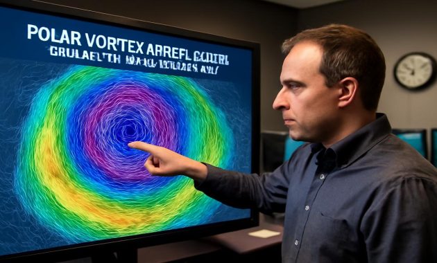
The wind had teeth that morning. Not the playful kind that nip at your scarf and pink your cheeks, but the kind that feels old—ancient, even—as if it has seen winters far more brutal than any you remember. You step outside, breath pluming into the pale air, and notice a strange tension in the sky: a sharp blue that feels brittle, like thin glass ready to crack. The forecast on your phone says something curious: “Patterns changing. Polar vortex disruption possible.” The phrase feels both scientific and ominous, like a warning from a distant, unseen machinery in the sky.
The Hidden Engine Above the Weather Map
Far above your head—much higher than the clouds, higher than the cruising jets, higher than the tallest storms—there is another sky most of us never think about. It is cold there, unimaginably cold, and dark for much of the winter. This is the stratosphere, and wrapped around the top of the world like a ghostly ring is the polar vortex.
We talk about the polar vortex now as if it’s a villain that sometimes “invades” our towns, but the truth is quieter and stranger: the polar vortex is supposed to be there. It is a vast whirl of frigid air, spinning tens of miles above the Arctic. When it is strong, it behaves like a well-disciplined guardrail, corralling the cold in the far north. When it weakens—or worse, breaks apart—its grip loosens, and the boundary between Arctic and not-Arctic starts to fray.
This winter, forecasters are watching that guardrail begin to wobble. Computers, fed with data from weather balloons, satellites, and ground stations, are hinting at a disruption in the polar vortex. Not just a passing ripple, but a genuine instability that could ripple downward and reshape the last act of winter across large swaths of the Northern Hemisphere.
Imagine the atmosphere as a layered symphony. The polar vortex is a deep, low note played high above, steady and sustained. But sometimes waves from the lower atmosphere—generated by mountain ranges, land–sea contrasts, and roaring jet streams—start pushing upward, like percussionists pounding on the floor beneath the orchestra. If those waves get strong enough, that low note fractures. The vortex strains, warms rapidly, slows down, even splits like a record cracking on the turntable.
What a Polar Vortex Disruption Really Means
Scientists have a name for this moment when the stratosphere sharply warms and the polar vortex stumbles: a Sudden Stratospheric Warming, or SSW. Temperatures up there can spike by 30 to 50 degrees Celsius within a few days—still far below freezing, but astonishing for that lofty realm. When you hear “warming,” you might think milder days are ahead. Paradoxically, at the surface, it can mean the exact opposite.
When the polar vortex becomes disrupted, the careful arrangement of wind, pressure, and temperature that usually keeps the Arctic cold mostly locked away begins to unravel. The jet stream, that high-speed river of air that guides storms, starts to kink and wander. Instead of flowing in a tight west-to-east band, it can buckle like a looping roller coaster. On one side of that loop, bitter air spills south. On the other side, warmth can surge unusually far north.
The result? Late winter becomes a roulette wheel. Some regions are suddenly plunged into a deep freeze that feels more like January than March. Others bask under odd springlike warmth that seems almost guilty, like borrowed weather. And in between, where cold and warm air collide, storms can blossom into sprawling, moisture-laden systems that turn commutes into epics and grocery lines into small talk about where all this snow came from.
The Strange Calm Before a Rearranged Winter
Right now, as you look out your window, nothing in particular might look extraordinary. Maybe the snow is stale and crusted, maybe the lawns are brown and patient, maybe the trees are biding their time in the bare geometry of branches. But above your quiet neighborhood, hundreds of miles overhead, the atmosphere is changing its mind.
Forecasters don’t speak of certainty here, but of probabilities, analogs, and patterns from past years when the polar vortex stumbled. They scroll through winters like 2009–2010 or 2018, when major disruptions led to unusual cold outbreaks over parts of North America, Europe, and Asia. They scrutinize spaghetti-like lines of model output, each one a slightly different version of the future. Together, they paint a picture that’s messy, but not meaningless.
One key thing stands out: the odds that late winter behaves “normally” are shrinking. Instead of a gentle slide toward spring, we may be heading toward a more dramatic finale—one with sharper contrasts, sudden flips, and unexpected regional winners and losers in the weather lottery.
In some scenarios, frigid Arctic air slumps into the central and eastern United States, while the West stays milder. In others, Europe gets the brunt of the cold, with icy winds spilling out across the continent. Some versions push the chill deeper into East Asia, or over parts of Canada that are already well acquainted with the phrase “too cold to snow.” The details will change as fresh data flows in, but the common thread is instability: the old map of “what late February and March should feel like” is starting to curl at the edges.
How a Broken Vortex Feels on Your Skin
All of this can sound abstract until the day the disruption arrives at your doorstep. It might begin subtly: a day that feels a bit too raw for the calendar, a wind that cuts instead of glides, a sky that never quite brightens. You zip your jacket higher than usual. The forecast mentions “Arctic blast” or “late-season cold surge,” and you feel that peculiar mix of dread and awe that major weather always brings.
Then the full force arrives. The air sharpens. Car doors creak when you pull them open. Your breath curls around your face mask and freezes faintly at the edges. Sidewalk salt crunches under your boots, a reminder of earlier storms, while a new one shapes itself in the distant, leaden clouds. The light becomes hard and metallic, as if the world has shifted into a different color temperature.
Or you might find yourself on the other side of the jet stream’s looping mood swing. Snowdrifts slump under a surprisingly mild sun. Puddles appear at the curbs, a wet gloss on the thawing streets. Birds sing a bit louder in the tangled hedges, fooled into thinking the season has turned a corner. Neighbors step onto porches in lighter jackets, half-smiling, half-suspicious, as if this warmth were a trick with a price to be named later.
The same disrupted vortex that grants one town a week of cold so intense it hollows sound out of the air might grant another town tulip weather a month early. Late winter loses its script and improvised scenes begin.
Where the Science Meets the Story
To the people studying these events, this winter’s polar vortex disruption is not just a curiosity; it is a living experiment in how a complex, warming climate interacts with a classic piece of atmospheric machinery. The polar vortex has always waxed and waned, but in recent decades, the background conditions have changed. The Arctic is warming faster than mid-latitudes. Sea ice retreats earlier and returns later. Snow cover patterns shift. All of these influence the atmospheric waves that can bully the vortex.
Some studies suggest that with a warmer Arctic, we may see more frequent or more disruptive vortex wobblings, especially when certain ocean patterns—like those in the North Atlantic or Pacific—line up just so. Other researchers caution that the story is not yet settled, that natural variability still dominates this high-altitude drama. But across disciplines, there is a shared sense of urgency: understanding these disruptions isn’t an academic puzzle; it’s a way to peer into the volatile edges of our seasonal expectations.
And for forecasters, a disrupted polar vortex is a test of skill and communication. How do you explain to someone that “warmer air high above the Arctic” could mean “colder weather in your town in three weeks”? How do you talk about probabilities—“a higher chance of cold outbreaks”—in a world that craves simple yes-or-no answers about snow days and planting dates?
| Possible Outcome | What You Might Notice | Typical Region Impacted* |
|---|---|---|
| Deep Cold Outbreak | Multi-day freeze, icy winds, increased heating demand | Parts of North America, Europe, or Asia |
| Late-Season Snowstorms | Heavy, wet snow; slushy roads; tree damage from weight | Mid-latitudes downwind of moisture sources |
| Unusual Warm Spells | Early thaws, mud, confused plants and insects | Regions under the warm side of jet stream loops |
| Pattern Whiplash | Rapid switches between warm and cold, snow and rain | Transitional zones between cold and warm air masses |
*Actual impacts vary by event and are influenced by local geography and broader climate patterns.
For ordinary people, the goal is simpler: to be ready for a late winter that may not behave as gently or predictably as you’d like. The disruption high above the Arctic doesn’t decide your local weather single-handedly, but it tips the scales. It says: prepare for surprises.
Living With a Moving Target Called “Normal”
There is a quiet grief in watching our idea of “normal winter” drift. Maybe you remember deeper snows that stuck for months, or crisp, reliable freezes that arrived in December and stayed. Maybe your childhood featured almanacs and farmer’s lore, rules of thumb you could trust: plant after this date, tap the trees around that one, expect the last big storm here.
Now, those certainties feel less certain. One year you might shovel a record-breaking blizzard in late March; the next year, crocuses nod in warm breezes under a bare-blue sky while winter seems to have simply forgotten to arrive. This potential polar vortex disruption is another reminder that the atmosphere does not owe us consistency. It moves according to physics and chaos, nudged by oceans, ice, and a planet that is, on average, warmer than it used to be.
And yet, within the swirl of anomalies and headlines, there is still daily life. Someone still has to walk the dog on the morning the Arctic air dives south. Someone still has to scrape the windshield, or decide whether to lace up running shoes for a surprise thaw. A school superintendent somewhere will stare at a radar image and a model snowfall forecast, weighing the safety of buses against the complaints of parents.
On a farm, a late-season cold outbreak can be more than an inconvenience. Buds urged awake by an early warm spell can be blackened by a sudden frost, entire orchards compromised in a single night. Livestock endure stress as temperatures seesaw. On city streets, aging water mains endure freeze–thaw cycles that pry and crack at their joints, turning quiet blocks into scenes of rushing, icy water and emergency repairs.
Reading the Sky While the Models Whisper
In weather offices around the world, forecasters stand between incomprehensible complexity and people simply trying to plan their week. They peer at vertical cross-sections of the atmosphere—thin, colorful slices showing winds surging like rivers, temperature layers bending and breaking. The polar vortex appears there as a band of strong westerly winds at stratospheric heights, usually tight and fierce. This year, that band is showing fractures.
As the disruption unfolds, the models begin to propagate its effects downward in time. A week, two weeks, three. A tendency emerges for high pressure to build in some regions, for cold pools to migrate. But within that tendency are thousands of possible details: where exactly the jet stream trough will dig, how a single storm will tap Gulf or Atlantic moisture, whether a cold front pauses over your town or sweeps through in a single, sharp night.
On the ground, there’s something almost comforting in doing the simplest, oldest thing: looking up. You don’t need to know the physics of the stratosphere to sense when a pattern is changing. Cirrus feathers spreading in from the west; a dull, persistent overcast that refuses to yield; the way the wind veers subtly from one direction to another over a day. These are the visible, tangible echoes of much larger shifts above.
Even if you never hear the phrase “Sudden Stratospheric Warming” on the evening news, you may feel its fingerprints. An extra week of heavy coat weather when your mind is already on gardens and baseball. A last, surprise storm heavy enough to snap tree limbs that were just starting to bud. Or an unnervingly warm stretch that melts snowbanks into memory long before you expected.
Reshaping Expectations, Not Just Forecasts
In the end, what a polar vortex disruption really breaks might not be the vortex alone; it might be our assumptions. We like rhythms: winter, then spring, then summer, then autumn, each with their moods and milestones. But the atmosphere’s deeper music has variations and improvisations we’re only starting to fully appreciate.
Late winter, in this new era, is less a gentle fade-out and more a wild coda. The coming weeks could see cold that feels like a flashback, snow that feels out of place on the calendar, or warmth that arrives too early and too fast. None of this is entirely new—weather has always held surprises—but the stage on which these surprises play out is tilting, ever so slightly, as the climate changes.
You don’t need to become an expert in stratospheric dynamics to live through it well. You only need to widen the space between “what I expect” and “what might actually happen.” Keep the heavier coat near the door a few weeks longer. Don’t be too shocked if spring takes one step forward and two steps back. Allow for the possibility that snow days may trade places with rain days, that mud season may be abruptly frozen over, then thawed again.
Some night soon, you may step outside and feel that sharp, crystalline cold that could have been imported from another latitude. Overhead, stars burn with winter intensity, the kind that makes the sky feel close and ancient. Somewhere, thousands of miles away, a piece of the Arctic has come visiting because the guardrail up high faltered. Or you may stand under a sky flushed with unexpected warmth, coat unzipped, air smelling faintly of wet soil and distant, uncertain spring. Both are part of the same story: a disrupted polar vortex, reshaping not just weather maps but the way we think about the season’s end.
Frequently Asked Questions
What exactly is the polar vortex?
The polar vortex is a large, persistent circulation of very cold air high in the stratosphere over the Arctic (and a similar one over Antarctica). It typically strengthens in fall and winter and weakens in spring. When it’s strong and stable, it tends to keep the coldest air confined near the pole.
What is a polar vortex disruption or Sudden Stratospheric Warming?
A polar vortex disruption, often linked to a Sudden Stratospheric Warming (SSW), occurs when rising atmospheric waves weaken or split the vortex. Temperatures in the stratosphere over the pole rise sharply, winds slow or reverse, and the usual circular flow of cold air becomes distorted. This can, over days to weeks, influence weather patterns lower in the atmosphere.
Does a disrupted polar vortex always mean extreme cold where I live?
No. A disruption increases the chance of cold outbreaks in some mid-latitude regions, but it doesn’t guarantee them for every location. Some areas may see intense cold, others may experience milder conditions, and some may notice little change. The specific impacts depend on how the jet stream responds and where the cold air is steered.
How far in advance can forecasters predict the impacts of a vortex disruption?
Forecasters can often detect signs of a potential disruption in the stratosphere one to three weeks in advance. Translating that signal into precise surface impacts—like when and where snow or cold will occur—is harder and usually becomes clearer only about 5–10 days ahead, as shorter-range models refine the details.
Is climate change making polar vortex disruptions more common?
Research is ongoing. Some studies suggest that a warming Arctic and changing snow and ice patterns may be linked to more frequent or intense disruptions in certain decades. Other analyses find the relationship less clear. Most scientists agree that the broader climate is warming, but how that warming affects specific features like the polar vortex is an active and evolving area of study.
How should I prepare for late-winter instability like this?
Stay tuned to trusted local forecasts, especially in the weeks following news of a vortex disruption. Be ready for swings in temperature, potential late-season snow or ice, and rapid thaw–freeze cycles. Practical steps include checking winter gear, protecting vulnerable plants if warm spells are followed by cold snaps, and allowing extra time for travel during changing conditions.
Why does “warming” high above the Arctic sometimes bring colder weather down here?
The “warming” in a Sudden Stratospheric Warming refers to the stratosphere, not the surface. When that layer warms and the polar vortex weakens, the jet stream below can become more wavy. Those waves create deep troughs that pull Arctic air south into some regions while sending warmer air north into others. So the warming aloft can translate into colder, not warmer, conditions at the ground in certain places.