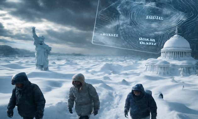
The first cold wind arrived before the trees were ready to let go. It slipped between houses just after sunset, rattling the last stubborn leaves and scraping along windowpanes like an impatient visitor. People noticed it in small ways: the dog that refused to stay outside; the barista who suddenly started steaming more milk than usual; the jogger who turned back half a mile early. No snow yet, no ice, no obvious drama—just the feeling that something in the air had shifted, a quiet hint that this winter might not behave like the others.
The Sky Is Sending Signals
A few weeks later, the maps began to glow. In weather offices across the country, meteorologists stared at swirling animations of the atmosphere: curling streaks of purple and blue, arrows chasing one another over the Arctic, pale patches of colder-than-usual ocean water pulsing near the equator. Here and there, someone leaned closer to a monitor, zooming in, running the sequence again.
“This is lining up,” one forecaster murmured to a colleague. “La Niña… and the polar vortex. If they sync just right, this could be the winter we talk about for a generation.”
Outside, people were still raking leaves and buying seasonal coffee drinks. School calendars were filling with concerts and exams. The idea of “historic winter” felt abstract, like something that happened to other places, in other years, captured in old black‑and‑white photos of snowbanks taller than buses. Yet above them—far above the hum and hiss of everyday life—the atmosphere was busy rearranging itself.
To understand the warning meteorologists are issuing now, you have to look up—and then, strangely, down. Up to the high-altitude rivers of wind that form the polar vortex, and down to the sloshing, shifting temperatures in the Pacific Ocean that define La Niña. The story of this potential winter is being written in those two distant places, waiting to be delivered to your street, your window, your front steps.
La Niña: The Ocean’s Cold Whisper
Imagine a vast breath being drawn along the equator, stretching from the coast of South America toward Indonesia. Along this enormous corridor, trade winds push warm surface water westward, allowing colder water from the deep to well up near the Americas. When this pattern is unusually strong and stubborn, meteorologists give it a name: La Niña.
La Niña doesn’t shout. It nudges. It cools a slice of the Pacific by a degree or two, and that small shift rearranges global weather patterns like a hand gently tilting a table. Storm tracks bend. Jet streams sag or sharpen. Some places dry out while others are soaked. Temperature maps, once placid, become mottled with extremes.
In this country, La Niña winters have a distinct fingerprint. The northern regions often tilt colder and snowier. The southern belts can swing between crisp, bright spells and bursts of wet, chilly weather. The interior may find itself in the crosshairs of frequent storm systems, the kind that begin as rumors on faraway radar screens and end as heavy, wet snow on your driveway.
But La Niña alone doesn’t guarantee a legendary winter. Sometimes its influence is blunted by other atmospheric players. Some La Niña years turn out merely “busy,” not infamous. The reason meteorologists are paying such close attention now is that this year, La Niña is not the only actor stepping onto the stage.
When the Polar Vortex Tilts Its Gaze
High above the Arctic, in the thin, frigid air of the stratosphere, Earth wears a kind of invisible crown. It’s a ring of powerful winds, circling the pole at tremendous speed, locking in the cold the way a lid keeps the chill inside a freezer. This spinning system is what we call the polar vortex.
Under normal conditions, the vortex is like a well-balanced gyroscope—stable, contained, whirling steadily above the far north. But it’s sensitive, too. Waves of energy rising from below, shifts in temperature, or disturbances in atmospheric flow can jostle it. Sometimes it wobbles; sometimes it elongates; and in rare, memorable years, it buckles and splits, letting Arctic air pour southward in bitter pulses.
We remember those winters by sensation: the sound of snow squeaking underfoot at twenty below, the way breath instantly crystallizes on scarves, the endless scraping of ice off windshields. Past polar vortex disruptions have frozen cities to a standstill, snapped water mains, and transformed familiar streets into glittering, dangerous sculptures of rime and frost.
This year, meteorologists see early signs that the vortex may be more vulnerable than usual. Its winds appear less tightly bound, its center a bit off-kilter. Long-range models hint at the possibility—never a guarantee, but a persistent suggestion—of a stretching or weakening event just as La Niña’s influence is peaking. If those two forces line up, the results could be stunning.
When Two Giants Align
Think of the atmosphere as a sort of orchestra. Each climate pattern—La Niña, the polar vortex, the jet stream, regional oscillations—plays its own instrument. Most winters are noisy but unremarkable, a jumble of notes that resolves into a familiar seasonal melody. Every so often, though, the instruments sync up in a way that’s both rare and unforgettable.
This is what has forecasters shifting in their chairs right now: the possibility that La Niña’s tendency to steer cold, stormy air over this country could align with a weakened polar vortex, allowing sharp blades of Arctic air to slice south more often and more deeply than usual. In that alignment, every passing storm has the potential to tap into truly frigid air. Snow systems can intensify faster, lake-effect bands can roar to life, and quiet drizzles can flip to blinding squalls with little warning.
The result is not just “more winter,” but a different kind of winter—one that shapes routines as much as it shapes landscapes. It’s the kind of season that rewrites bus schedules, disrupts supply chains, and sends people rushing to hardware stores for the last remaining bags of ice melt.
For meteorologists, this possibility is both thrilling and sobering. Forecast offices thrive on pattern recognition, on spotting the fingerprints of past winters reappearing in the present. The charts on their walls—snowfall records, historic cold spells, epic storms—are not just data; they’re stories. And in those stories, years when La Niña and a disturbed polar vortex have intersected often carry asterisks and underlines.
What the Models Are Whispering
Computer models are not crystal balls; they are crowded rooms full of probabilities. Each run of a model offers a different possible future, and meteorologists spend their days comparing these futures like overlapping transparencies. No single outcome is certain, but when many of them begin to rhyme, it’s time to pay attention.
This season, the rhymes are striking. Many projections show colder-than-average conditions gripping northern and interior regions, with frequent swings of temperature farther south. Storm tracks often appear draped across the heart of the country, looping like question marks between coasts. One set of models paints a pattern of repeated cold outbreaks—short, sharp plunges of Arctic air, followed by temporary thaws, then another dive.
When you layer La Niña’s signature onto these maps, and then add in the possibility of a polar vortex wobble, the ensemble becomes clear enough for a warning, though never precise enough for guarantees. This may be the winter of blocked driveways and frozen pipes, of overloaded plows and record-breaking snow totals in some regions. Not everywhere, and not continuously—but enough to be called “historic” when we look back.
How a Historic Winter Feels at Street Level
The language of meteorology can feel distant: anomalies, oscillations, indices. But you won’t experience this possible winter in numbers; you’ll feel it with your hands on a frozen door handle, your breath shimmering in headlights as you scrape the windshield in the predawn dark.
You’ll notice it first in the way the cold settles—not just overnight, but in the afternoon, when the sun is still technically up yet seems unable to do its job. Sidewalks stay slick even past noon. The snow doesn’t melt away between storms; instead, it layers, compresses, and toughens into something almost geological.
In neighborhoods, the ordinary soundtrack of winter deepens. The hum of traffic is muffled by snowbanks. Shovels scrape and clang. Somewhere, a snowblower snarls to life again—and again. Children’s laughter floats over the drifts, high and bright, while a few wary parents watch the leaden sky and mentally revise tomorrow’s commute.
Historic winters reshape small rituals. The quick walk to the mailbox becomes a miniature expedition. People keep spare gloves in the car, extra blankets in the trunk, emergency snacks tucked into their work bags. Neighbors you usually just nod to in summer suddenly share conversations over snow shovels, trading tips on roof rakes and salted steps.
And then there are the storms that become stories. The one that arrived faster than expected, turning evening errands into hours-long crawls home. The lake-effect band that refused to move, burying one side of town while the other watched in baffled sunlight. The morning your door wouldn’t open because a drift had walled it shut overnight, smooth as poured concrete.
What This Might Mean for Daily Life
Should the forecasted alignment unfold, winter will not just be scenic; it will be logistical. Here are some of the everyday ripples people may feel:
- Transportation: More frequent and intense snow events can mean recurring airport delays, highway closures, and icy backroads. Commuters may find themselves building buffer time into every trip.
- Energy use: Prolonged cold spells push heaters harder and longer. Power grids feel the strain. Households watch their bills rise as furnaces cycle almost constantly.
- Infrastructure: Repeated freeze-thaw cycles crack pavement, split water mains, and test the limits of older buildings and bridges.
- Schools and work: Snow days and remote work may once again become part of the vocabulary, not just for storms, but for cold so severe it makes even short walks hazardous.
- Health and safety: Extended cold can be dangerous for vulnerable populations, outdoor workers, and anyone without reliable heat. Emergency services may face heightened demand.
And yet, within all that hardship, winter brings its own strange tenderness. Strangers push each other’s cars out of snowbanks. People shovel not just their own steps but maybe the neighbor’s too. The landscape, newly simplified under snow, teaches a slower kind of attention—the way branches hold ice, the way light reflects off frozen rivers in a muted, pewter glow.
At a Glance: How This Winter Could Compare
Forecasts are never perfect, but a number of signals line up strongly enough that meteorologists have begun sketching out broad expectations. Here is a simplified look at how this winter might stack up against a more typical season in this country:
| Region | Typical Winter | This Winter (La Niña + Polar Vortex Risk) |
|---|---|---|
| Northern & Interior Areas | Cold with periodic snowstorms | Colder than average, frequent storms, risk of prolonged snow cover |
| Coastal Zones | Mixed rain and snow, milder temperatures | Sharp swings between heavy wet snow and cold rain; occasional coastal blizzards |
| Southern Belt | Cool, mostly rain, brief cold snaps | More dramatic cold spells, icy events possible, bursts of wintry mix |
| Highlands & Mountain Areas | Reliable snowpack, seasonal storms | Enhanced snowfall, deeper snowpack, greater avalanche concerns |
Preparing for a Winter That Might Rewrite the Records
The atmosphere will do what it will do. None of us can talk a jet stream out of dipping south or convince a polar vortex to stay neatly over the Arctic. But we are not powerless. Preparation is its own quiet form of respect—for nature, for neighbors, for the fragile systems we rely on.
In some ways, preparation is as simple as looking around your own life and asking where the cold can most easily slip through.
- Your home: Drafty windows, uninsulated pipes, aging roofs—these are winter’s favorite targets. A weekend spent sealing gaps, wrapping pipes, and clearing gutters now can prevent a much more dramatic weekend later, spent mopping up leaks or dealing with frozen plumbing.
- Your vehicle: Thick ice and heavy snow do not care how rushed you are. Winter tires, a sturdy snow brush, jumper cables, and an emergency kit with water, snacks, and a blanket can turn a dangerous delay into a manageable inconvenience.
- Your routine: Build winter slack into your expectations. Allow extra time for commutes. Be ready for last-minute schedule changes. Stock a little extra food and medication so you’re not forced onto treacherous roads during a storm.
- Your community: Look out for those who may have fewer options—elderly neighbors, people without reliable heat, anyone who walks or bikes to work. Historic winters are easier to bear when communities lean in toward one another.
In emergency management offices, planners are already ticking through checklists: salt supplies, plow routes, backup generators, shelter plans. Hospitals are reviewing protocols for cold-related illnesses. Utility companies are inspecting lines and transformers. Everyone, in their own corner, is having the same quiet conversation: If this winter is as big as it might be, will we be ready?
Living With Uncertainty, Not Fear
There’s a temptation, when faced with phrases like “historic winter,” to imagine only the worst: endless storms, failing grids, cities frozen into paralysis. Reality is usually more complex. Some regions may indeed set records for snowfall or cold, while others are merely inconvenienced. Some weeks will be remarkably harsh; others will bring brilliant, crystal-clear days that feel almost gentle despite the cold.
Meteorologists are careful with their words because they know how many ears are listening. When they warn that this country may face a historic winter, they are not promising catastrophe. They are sounding a thoughtful alarm based on converging evidence—La Niña strengthening, the polar vortex showing signs of vulnerability, long-range models aligning in unusual ways.
The goal is not fear, but readiness. It is to give people enough time to see the season coming and adjust, instead of waking up in mid‑January wondering how it all arrived so quickly.
Meanwhile, the sky continues its quiet work. High above, winds rearrange themselves in delicate, massive ways. Over the Pacific, cooler water continues to well up, tugging on the strings of the atmosphere. Over the Arctic, the polar vortex spins, steady for now, yet watched from below with a mixture of awe and concern.
Soon, perhaps sooner than you expect, you will open your door one morning and know that the long-range forecasts were onto something. The cold will feel deeper, the snow heavier, the silence outside thicker and more complete. The country will be caught in a shared experience—a winter written not only in headlines and records, but in the small, intimate moments of breath-clouded air and the crunch of boots on hardened snow.
Historic or not, the season is coming. How we move through it—prepared, attentive, maybe even a little humbled—will become part of the story we tell when the thaw finally arrives.
Frequently Asked Questions
What makes this winter potentially “historic”?
Meteorologists are watching an unusual overlap of two powerful climate influences: a strengthening La Niña in the Pacific Ocean and signs that the polar vortex may weaken or wobble later in the season. When these patterns align, they can send repeated waves of Arctic air into this country and energize winter storms, increasing the odds of record-breaking cold or snowfall in some regions.
Does La Niña always mean a severe winter?
No. La Niña tilts the odds toward certain patterns—like colder, snowier conditions in some northern and interior areas—but it does not guarantee a severe winter on its own. The impact depends on how La Niña interacts with other factors, such as the jet stream, regional climate patterns, and, this year, the behavior of the polar vortex.
What exactly is the polar vortex?
The polar vortex is a large, persistent circulation of very cold air high above the Arctic, in the stratosphere. When it is strong and stable, most of the cold stays near the pole. When it weakens or becomes distorted, pieces of that frigid air can spill southward, causing intense cold snaps far from the Arctic.
Will every part of the country be hit equally hard?
Probably not. While the country as a whole may experience a more dramatic winter, impacts will vary by region. Northern and interior areas are more likely to see extended cold and heavy snow, while coastal and southern regions may experience sharp temperature swings, icy events, or occasional major storms rather than constant extreme conditions.
How can I practically prepare for this kind of winter?
Start with the basics: insulate your home, protect water pipes, service your heating system, and prepare a small emergency kit with food, water, medications, and warm clothing. Equip your vehicle with winter tires and safety supplies, and build extra time into travel plans. Check in on neighbors, especially those who may have limited heating or mobility, and stay informed by following local forecasts and advisories.