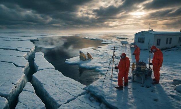
The first thing you notice is the quiet. Not the everyday, city-on-a-Sunday quiet, but a deeper, listening kind of silence—the kind that makes you stop mid-step and wonder what the weather is trying to say. The sky looks ordinary enough, brushed with soft grey clouds and a tint of winter blue, but somewhere high above that calm facade, winds scream along invisible boundaries. In distant offices full of flickering monitors and glowing maps, meteorologists are watching those winds twist and fray. They have a name for what might come next: an Arctic breakdown. And they are starting to warn that early February could be the trigger.
When the Sky’s Engine Starts to Stutter
To understand what has the experts restless, you have to imagine the atmosphere as a layered, humming machine. Up near the edge of space, about 30–50 kilometers above our heads, a powerful ribbon of wind circles the North Pole. It is called the polar vortex, and in a normal winter it acts like a tight, spinning lock that keeps frigid Arctic air bottled up far to the north.
On weather maps, that locked-in cold looks like a swirling blue crown around the top of the world. Below it, at the level where clouds form and storms roll, the jet stream curves and bends, but usually follows the lead of that upper-level vortex. For many of us living in mid-latitudes, the result is familiar: a few icy snaps, some grey drizzle, maybe a snow day or two—winter as a negotiated compromise.
But this winter, high above the snowfields and frozen seas, the rhythm is changing. Strange pulses of warmth are pushing up into that icy domain, weakening the polar vortex, slowing it down, and in some computer models, pulling it apart. Meteorologists have a technical term for this: a sudden stratospheric warming event, or SSW. The phrase sounds benign, almost gentle, but its consequences can be anything but.
“When the vortex weakens,” one forecaster explains over a crackling call, “it’s like unlocking a freezer door and walking away. The cold doesn’t stay politely put. It spills out where gravity and circulation patterns take it.”
The Anatomy of an Arctic Breakdown
That “freezer door” image is the easiest way to picture what an Arctic breakdown really is. Instead of a cold pole and relatively milder middle latitudes, the temperature pattern can suddenly flip, shuffle, or stretch like melting wax. The Arctic warms up while lobes of polar air slump southward into North America, Europe, or Asia.
In the language of the models, the vortex can “displace” or “split.” Displaced, it slides off the pole like a spinning top nudged off-center. Split, it fractures into two or more smaller whirlpools of cold, each wandering off along different paths. For people on the ground, those technical nuances translate into something very simple: you either get suddenly plunged into bitter, prolonged cold, or you breathe a sigh of relief as the worst of winter passes you by—while someone else, half a continent away, shivers through the consequences.
Right now, the stratosphere is sending out all the nervous signals of a system under stress. Temperature profiles suggest warming high above the pole. Wind speeds that usually roar are softening. Forecast charts show the vortex wobbling and stretching, as if it is being tugged from several sides at once. Early February keeps flashing on the screens, highlighted in anxious colors.
What has meteorologists especially alert this time is the alignment: a potential major stratospheric disruption coming just as the lower atmosphere is primed with sharp gradients between cold snow-covered land and comparatively warm oceans. That pairing means any breakdown up high has plenty of raw material below to shape into intense weather.
What Early February Could Feel Like
Translating the language of ensembles and anomalies into everyday life is as much art as science. If you step outside in early February, and the Arctic breakdown does unfold, you will not see the polar vortex itself. You will feel its ghost in the wind.
In some regions, that might mean a sharp, almost physical line between seasons. One day, damp chill and drizzle; the next, a knife-edged cold that makes your breath sting and turns every puddle into crystal. Streetlights could glow through veils of fine, dry snow—the kind that squeaks underfoot and flows like sand around your boots.
Rivers and lakes that barely skimmed with ice in January might rapidly lock over, the ice growing thick enough to hold the weight of deer, foxes, and, sometimes unwisely, people. In forested hills, the soundscape would change: branches crack loudly in the deep cold, and even the birds rearrange their routes, hugging thickets and sheltered ravines.
Elsewhere, the breakdown could twist the jet stream into a new pattern that funnels milder Atlantic or Pacific air over places usually braced for winter’s worst. There, people might step into an oddly gentle February: skies washed in pale sunshine, fields weeping mud instead of creaking frost. The air would smell of thawing leaves and early soil, while thousands of kilometers to the west or east, storms chuck great banks of snow against shuttered windows.
And in yet other regions, the jet stream’s new contortions might set up long-lived storm tracks: snow systems riding the same invisible rails again and again, layering white upon white, freezing rain upon snowpack, straining roofs and nerves alike.
The Lives Tied to a Wandering Jet
We often talk about weather as small talk, but a high-risk Arctic breakdown scenario is anything but trivial for the living world. Farmers eye their winter wheat and rapeseed and wonder if a false thaw followed by extreme cold will scald the green life just beginning to stir. Migratory birds, guided by a clock of daylight and temperature, can be lured northward too early into landscapes that snap back into deep winter the moment they arrive.
In cities, municipal engineers examine salt reserves and winter maintenance budgets, knowing that even a few weeks of intense cold can turn a manageable season into a logistical scramble. The icicles that look so quaint along old brick buildings can hide burst pipes and overburdened gutters. Homeless outreach teams, already stretched thin, prepare for an increase in calls and cold-weather emergencies.
In mountain communities, ski resorts watch the charts with mixed emotions. A surge of cold and repeated storms can bring fresh powder and a late-season boom, but it can also amplify avalanche risk. The same new snow that delights skiers can slide swiftly on older, brittle layers, turning quiet bowls and chutes into deadly chasms of moving ice and debris.
Why Forecasts Sound So Cautious, Yet So Concerned
When meteorologists talk about a “high risk scenario,” they are choosing their words carefully. They are not prophesying a specific storm on a specific day; they are reading the mood of the atmosphere, the way a seasoned hiker might watch the sky darken over the ridgeline and decide that, while it is still technically calm, it is wise to head for the tree line.
Forecast models run many different possible pathways into the future, each starting from slightly different assumptions about temperature, wind, and pressure. Together, these simulations form an ensemble—a chorus of what-ifs. Over the polar regions right now, that chorus is not singing in harmony, but enough of its voices are bending toward disruption that experts feel compelled to raise the alarm.
Some model runs show dramatic splits of the vortex, with cold spilling deep into central and eastern North America or sweeping, tongue-like, across Europe and into parts of Asia. Others show a more modest distortion—enough to tangle storm tracks but not to dig a continent-wide freezer trench. The probabilities shift hour by hour, but the recurring theme in many of those digital futures is this: early February is a pivot point.
This is why the language is careful yet urgent: “elevated potential,” “increased risk,” “high likelihood of disruption” rather than absolute predictions. The atmosphere is a chaotic storyteller, one that loves late twists. But ignoring the signals would be like ignoring smoke in a dry forest.
How This Winter Fits a Larger Pattern
Every big winter event now unfolds against the long shadow of climate change. A warming planet sounds, at first, like it should mean fewer brutal cold spells, not more. Yet the relationship between the shrinking Arctic ice, the warming oceans, and the polar vortex is proving to be complex and, at times, counterintuitive.
The Arctic has been heating up faster than the rest of the globe, eroding some of the stark temperature contrast between pole and mid-latitudes that helps keep the jet stream tight and fast. Some researchers argue that this weakening can make the jet wobblier, more prone to looping southward and stalling, which in turn can help facilitate episodes of severe cold in places unaccustomed to it—or extend wintry grips in regions that used to count on quick thaws.
The science is still unfolding, and not every expert agrees on how strong the link is between a warming world and more frequent Arctic breakdowns. But what is clear is that extremes—of heat, of rain, of drought, and yes, of cold—are becoming more noticeable in our lived experience. The dice are being loaded, and though the outcome of any single roll (or any single winter) is uncertain, the odds of “unusual” weather keep creeping up.
Preparing for a Winter That Might Suddenly Remember Its Teeth
If the early-February scenario does tilt toward a full Arctic breakdown, the most meaningful impacts for most of us will not be in the stratosphere, but in our daily routines. Preparation, in this sense, is not about panic. It is about attentiveness.
At home, it might be as simple as checking that drafty window you have been ignoring, or confirming that the emergency kit tucked away in the closet actually has batteries that still work, a flashlight that still turns on, and enough basic supplies to get you through a few days without a store run. It might mean looking at that old tree limb leaning a little too close to a power line and making a phone call before an ice storm does the pruning for you.
For those living in rural or isolated areas, preparations take on a more practical gravity: stacking extra firewood, filling fuel tanks, making sure livestock have reliable shelter and access to unfrozen water. Winter storms after an Arctic breakdown can arrive in trains, one after another, and each one puts another layer of strain on systems that may have already been close to their limits.
| Focus Area | Simple Actions Before Early February |
|---|---|
| Home & Shelter | Seal drafts, service heating systems, have blankets and backup light sources ready. |
| Travel & Commuting | Keep fuel tanks above half, pack a small car kit (water, snacks, scraper, shovel). |
| Health & Vulnerable People | Check in on elderly neighbors, refill essential medications early, plan for power outages. |
| Work & School | Know remote-work and school-closure plans; keep important files accessible from home. |
| Outdoors & Nature | Prepare for changing trail and ice conditions; respect avalanche and storm warnings. |
None of this is glamorous, but in the quiet moments before a storm track locks in or a cold wave dives south, practical steps like these turn uncertainty into something more manageable. They also invite us to think about weather not as a background nuisance, but as a living force that we are in constant dialogue with.
Listening to the Wind Again
As early February approaches, there will be a temptation to focus solely on the extremes: the record-breaking lows, the dramatic satellite loops, the single jaw-dropping photo of a lighthouse encased in ice or a city street vanishing under drifts. But there is another way to move through a winter like this—one that folds curiosity into caution.
Stand outside for a moment on one of those charged mornings when the forecast feels uncertain and the meteorologists’ voices carry that thin thread of concern. Notice where the wind is coming from, how the air tastes—metallic and dry, or heavy with moisture. Watch how the birds fly, low and direct or wandering and relaxed. These small, sensory details are how people have read the sky for millennia, long before polar vortexes had names and sudden stratospheric warmings were plotted pixel by pixel.
We now have satellites, supercomputers, and decades of climate data layered into every forecast, yet the act of paying attention remains profoundly human. When meteorologists warn of a high-risk Arctic breakdown scenario, they are not just reading graphs; they are, in their own way, listening. They are attuned to the stories the atmosphere has told before and are trying to recognize when a familiar tale is starting again.
Whether this early February brings you ankle-deep slush or air so cold it crackles, it is worth remembering that you are part of that story too. Weather is not happening to us from some distant, detached realm. We breathe it, walk through it, build our lives around its moods. In the weeks ahead, as the polar winds decide whether to hold fast or let go, the best we can do is stay alert, stay prepared, and stay willing to notice.
Above us, the vortex turns and trembles. Below, we zip our coats, check in on each other, and wait to see which way the wind will finally blow.
FAQ: Arctic Breakdown and Early February Weather Risks
What exactly is an “Arctic breakdown”?
An Arctic breakdown is an informal way of describing a situation where the usual barrier that keeps very cold Arctic air near the pole weakens or fails. Often, this is linked to a disruption of the polar vortex. When that happens, frigid air can surge south into mid-latitudes, causing severe cold spells and shifting storm tracks.
Does an Arctic breakdown always mean extreme cold where I live?
No. The cold air that escapes the Arctic has to go somewhere, but it does not spread evenly. Some regions can experience prolonged, intense cold and snow, while others may actually see milder conditions. The exact outcome depends on how the jet stream bends and where the displaced cold air settles.
Why are meteorologists focusing on early February?
Model simulations and observations in the upper atmosphere are hinting at a significant weakening or disturbance of the polar vortex around that time. Because it can take one to three weeks for those changes high above to fully influence surface weather, early February is emerging as a key window when impacts are most likely to appear.
Is this connected to climate change?
There is growing research suggesting that rapid warming in the Arctic and loss of sea ice may influence the behavior of the polar vortex and the jet stream, possibly making disruptive events more likely or more intense. However, the relationship is complex and still actively studied. Climate change does not cause any single Arctic breakdown on its own, but it can tilt the odds and alter the backdrop against which these events occur.
How can I best prepare without overreacting?
Focus on simple, practical steps: stay updated with trusted local forecasts, prepare your home and vehicle for a period of severe winter weather, and make plans to check in on vulnerable neighbors or family members. Preparation is less about expecting catastrophe and more about reducing the stress of surprises.
How long can the effects of an Arctic breakdown last?
Once the polar vortex is significantly disturbed, its influence on surface weather can persist for several weeks. That might mean a long cold spell in one region, repeated snowstorms in another, or a sustained pattern of unusual mildness somewhere else, depending on how the jet stream reorganizes.
Is there anything we can do beyond individual preparation?
On a broader scale, communities and local governments can invest in resilient infrastructure, reliable warming centers, flexible work and school policies, and clear communication systems. Over the long term, efforts to address climate change and protect natural landscapes also play a role in moderating the extremes our societies will have to adapt to.