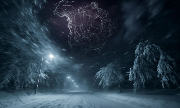
The first hint is not what you see, but what you feel. The air has that sharp, metallic edge it gets just before a deep freeze, even though the calendar insists that spring is close. You notice the way sound seems to travel farther at night, as if the cold is already stretching its fingers through the streets, turning every footstep into a brittle echo. Somewhere high above this ordinary evening, far beyond the city lights, a spinning river of icy wind is beginning to falter—and the atmosphere is quietly rearranging its plans for March.
A River of Wind You Never See
We talk about winter as if it lives close to the ground: snow piling on sidewalks, frost on car windshields, the slow scrape of shovels at dawn. But the story of what’s about to happen in March begins much, much higher—roughly 30 to 50 kilometers above your head, in a part of the atmosphere most of us never think about.
Up there, circling the Arctic like a ghostly crown, is the polar vortex: a vast, spinning pool of frigid air trapped by powerful winds. On satellite images, it looks like a swirling bruise draped over the North Pole. It is not a single storm, not a blizzard or a front. It’s a structure—an engine—that helps lock the cold in place, keeping the worst of the Arctic’s icy breath penned in at high latitudes.
On most winters, this upper-level vortex stays more or less intact, wobbling but holding its shape, the way a top spins with only minor shivers. When it’s strong, the Arctic cold is contained, like water in a deep, sturdy bowl. Storms still come and go at the surface, but they ride along tidy tracks, mostly predictable, mostly seasonal.
This year, though, the top is starting to wobble hard. And for a small group of scientists who spend their careers staring at wind speed charts and pressure maps, the signals are unmistakable: the polar vortex is weakening, tilting, and beginning to split. A rare shift is underway—and if history is any guide, the impacts will not stay in the stratosphere for long.
The Moment the Sky Breaks Its Routine
Inside climate labs and forecast centers, winter is experienced as colors and lines. Maps bloom in blues and purples as temperatures fall, arrows show the screaming winds roaring around the pole, and numbers flicker like heart monitors as the atmosphere pulses from day to day.
In early February, those maps began to show something unsettling. The tight ring of wind that usually cages in the cold air was losing strength, slowing down like a tired engine. In some regions, the winds even began to reverse direction—a signal meteorologists know well and rarely take lightly. It’s called a sudden stratospheric warming event, and despite the deceptively cozy name, it’s often the first domino in a chain that leads to brutal cold snaps.
It works like this: waves of energy from lower in the atmosphere—triggered by mountains, land-ocean contrasts, and powerful storms—push upward and slam into the polar vortex. Imagine someone dropping rocks into a whirlpool. The smooth spin begins to buckle, then shatter. Temperatures in the stratosphere over the Arctic spike sharply as the vortex is disrupted, sometimes by 30 or 40 degrees Celsius in a matter of days—still cold, but far less frigid than usual.
When that happens, the once-coherent vortex can do three things: weaken and wobble, shift away from the pole, or split into two or more smaller vortices. Right now, the models suggest a splitting pattern is emerging—a kind of atmospheric crack that could send chunks of the Arctic’s cold reservoir sliding toward lower latitudes.
This change doesn’t stay aloft. Over the span of one to three weeks, its fingerprints slowly descend, nudging the jet stream out of its usual west-to-east march, carving exaggerated loops into weather patterns that once looked more like a flowing ribbon than a wild scribble.
Why March, of All Months, Could Turn on You
By the time March arrives, most people in the mid-latitudes have mentally moved on. Seed catalogues appear in mailboxes. Coats migrate to the backs of closets. Daylight stretches just a bit longer each evening. It feels like we’ve crossed some invisible line out of winter’s reach.
But the atmosphere does not read calendars, and a disturbed polar vortex has its own sense of timing. After the initial rupture high above the Arctic, the chaos needs time to work its way down to the world we live in. If the current projections hold, that moment of impact—where the upper-level disruption couples with the surface—could align almost perfectly with early to mid-March.
Imagine the jet stream—not as an abstract line on a weather graphic—but as an airborne river guiding storm systems and temperature boundaries. When the polar vortex weakens and splits, that river starts to meander dramatically. Deep troughs of cold air punch southward; equally exaggerated bulges of warmth surge north. In one region, you might step into air that feels like a late-December afternoon. A few hundred miles away, people might be eating lunch outside in shirtsleeves, standing under a gentle sun that feels stolen from April.
This is the paradox of a polar vortex disruption: it can bring both extremes at once. While one part of the continent shivers under unusual snow and piercing winds, another might be drenched in out-of-season rain or wrapped in unseasonable warmth. But the risk that has experts leaning forward in their chairs, hands wrapped around empty coffee mugs, is the threat of sharp, punishing cold returning when we’ve already begun to let our guard down.
What “Unusually Extreme” Could Really Mean
When scientists say “unusually extreme winter conditions,” it can sound almost polite—like a clinical label for something that may, in reality, feel like a slap. To bring it closer to home, picture waking up in mid-March to find your world suddenly dialed back to mid-January.
Sidewalks that were bare yesterday now host a new crust of snow and ice. The air, which had felt almost soft the day before, now hits your lungs with a harsh, needling burn. A warm spell that coaxed trees into budding early is replaced by a brutal freeze that turns delicate green tips into blackened, frost-bitten scars.
Power lines sag under the weight of unexpected wet snow. Roads glaze over as cold air barrels in behind a band of freezing rain. In some regions, Arctic air slides over relatively warm lakes and seas, brewing dangerous lake-effect snowstorms or coastal squalls that dump thick, blinding bands of snow in narrow, unlucky corridors.
“Extreme” doesn’t always have to mean records shattering by ten degrees or snow measured in meters. Sometimes it means timing: cold arriving weeks later than normal, storms striking when infrastructure, wildlife, and people have mentally and physically shifted gears toward spring.
Here is how a polar-vortex-driven March might differ from a more typical late-winter season:
| Feature | Typical March | March with Polar Vortex Shift |
|---|---|---|
| Temperature Trends | Gradual warming, frequent thawing days | Sudden cold plunges, Arctic outbreaks, wild swings |
| Storm Behavior | Mixed rain and snow, weakening systems | Stronger, slow-moving storms with heavy snow or ice |
| Jet Stream Pattern | Gentler waves, more zonal (west–east) | Deep loops, blocking patterns, stalled weather |
| Impacts on Daily Life | Intermittent disruptions, relatively short-lived | Cold snaps after warm spells, infrastructure stress, higher energy demand |
| Ecosystem Effects | Gradual thaw, early but manageable budding | Frost damage to early blooms, stress on wildlife and crops |
In practical terms, a polar-vortex-tilted March may feel less like a gentle glide into spring and more like taking two steps forward, three steps back—over and over again.
The Quiet Collisions in Your Backyard
You don’t need a satellite feed to notice when the atmosphere has shifted gears. You can read it in small, strangely intimate details close to home.
Walk through a park after one of these late-season cold surges, and you might see daffodils that dared to bloom early, their yellow trumpets now folded and wilted under a crust of ice. Buds on fruit trees, swollen and optimistic after a false spring, stand vulnerable to a frost that could erase an entire season’s harvest before it even starts. Bees that ventured out on a warm afternoon find nothing waiting for them the next day but frozen blossoms and bitter air.
Even the soundscape changes. Birds that had begun their tentative spring songs fall back into a wary quiet, their calls replaced by the creak of frozen branches. Streams that had broken free of winter’s lid slow again under nighttime temperatures that drop unexpectedly low, the thin new ice groaning and cracking as water keeps pushing beneath.
Humans, too, feel the whiplash. A sunny 55-degree (13°C) day fills sidewalks with joggers and café tables with people sipping coffee outdoors, jackets open, faces upturned. Two days later, the same city might wake to sleet rattling against windows, buses delayed by slick roads, and a spike in heating bills as furnaces roar back to life.
These are the quiet collisions of seasons that happen when the deep machinery of the atmosphere misfires or changes rhythm. And this year, that rhythm is already off.
How We Know This Isn’t Just Normal Winter Drama
It’s tempting to write all of this off as weather doing what weather does: being fickle, being dramatic, being moody. After all, “March is unpredictable” is practically a proverb in many places. So how do we know there’s something different at play this time?
The answer lies in patterns that repeat often enough to be recognized—yet rarely enough to be remarkable. Over the past few decades, meteorologists and climate scientists have tracked how sudden stratospheric warming events and polar vortex disruptions ripple downward into the lower atmosphere. When the vortex breaks in certain ways, specific regional outcomes become more likely.
For Europe and parts of North America, that often means higher odds of cold spells, late snows, and persistent high-pressure “blocks” that can trap cold air in place. For other regions, like parts of the Arctic or some sections of Asia, it can mean the opposite: milder, even balmy conditions, under a displaced bubble of warm air.
Historical examples back this up. The notorious cold wave that froze much of the United States in early 2014, and the bitter outbreaks of 2018 and 2021, were all linked in part to polar vortex disruptions. Not every event is identical, and not every disruption guarantees record-shattering cold everywhere. But the fingerprints are there: a clear, traceable line from the upper-atmosphere breakdown to ground-level chaos.
This year’s developing vortex shift fits that familiar, disquieting pattern. The winds are weakening in the right place, at the right height, at the right time. The models, which have grown far more sophisticated in recent years, are nearly humming in agreement: March will not be a quiet exit from winter.
Preparing for a Winter That Refuses to Leave
Knowing that a disrupted polar vortex is on the way is only half the story. The other half lives in our response: in the choices we make when the calendar says one thing and the sky says another.
On a personal level, preparation doesn’t have to be complicated. It might mean delaying that optimistic wardrobe shift, keeping your heaviest coat and boots within arm’s reach a few weeks longer than usual. It might mean checking that your car’s emergency kit is still stocked, or that there’s a backup plan for elderly relatives or neighbors who are more vulnerable to power outages or sudden cold.
For communities, the stakes are higher. Late-season storms can snarl transportation networks that were already easing into spring schedules. Road crews that have begun to pivot away from winter operations may suddenly face a renewed round of snow and ice control. Hospitals may need to prepare for a secondary wave of cold-related injuries—slips, falls, frostbite—that usually peak earlier in the season.
Farmers and gardeners tread an especially narrow line. Early warmth may be tempting, but when a polar vortex disruption looms, caution is its own kind of harvest. Waiting a little longer to prune, plant, or uncover sensitive perennials can be the difference between a thriving season and one marred by frost damage. Protective coverings, windbreaks, and careful timing become quiet acts of resilience.
And then there is the more subtle, emotional preparation: allowing yourself to accept that spring might arrive not as a smooth, cinematic transition, but as a stuttering sequence of false starts. There’s a kind of peace that comes from expecting the setback instead of being blindsided by it.
A Glimpse of a Future Written in Extremes
As we look up at this wobbling polar engine, it’s impossible not to wonder about the broader canvas it sits on. The background climate is warming; that much is clear. But as the Arctic heats up faster than the rest of the planet, the temperature difference between the pole and mid-latitudes changes—and with it, the behavior of the jet stream and polar vortex.
Some researchers argue that this “Arctic amplification” might be making disruptive vortex events more frequent or more impactful. Others caution that the evidence is still emerging, the connections complex. What’s less debated is the lived reality: people around the world are experiencing more weather that feels like an exclamation point—sudden, intense, out of season.
This year’s rare polar vortex shift is part of that unfolding story. Not a cause, not a cure, but a vivid example of how a warming world does not simply mean a linear slide into milder winters. It means volatility. It means deeper contrasts. It means, sometimes, a March that bites harder than January.
Stand outside on one of the coming nights when the air feels sharper than it should. Look up, beyond the sodium glow of streetlamps, into the darkness where that invisible river of wind curls and stutters. Somewhere far above, the atmosphere is rearranging its invisible gears. The cold is gathering itself, plotting new paths.
It may arrive as a sudden, glassy silence after a thaw, as a storm that lingers too long, as a wind that cuts a little deeper than you expected when you stepped outside without gloves. When it does, you’ll know this wasn’t just “bad luck March.” It was written weeks earlier, in a vast spinning crown of air at the top of the world that, for a brief moment, forgot how to hold itself together.
Frequently Asked Questions
What exactly is the polar vortex?
The polar vortex is a large, persistent circulation of very cold air high in the atmosphere above the poles, especially the Arctic. It’s not a single storm, but a broad, swirling system of strong winds that typically keeps frigid air locked near the pole during winter.
Does a polar vortex shift always mean extreme cold where I live?
No. A disrupted polar vortex increases the odds of extreme cold in some regions, but not everywhere. Some areas may see intense cold snaps and snow, while others experience milder conditions or less dramatic changes. Local impacts depend on how the jet stream responds and where the cold air is steered.
Why are experts focusing on March this year?
Because it takes one to three weeks for changes in the upper atmosphere to influence surface weather. The current disruption is occurring late in winter, which lines up its potential impacts with early to mid-March, a time when many regions usually begin to warm.
Is this polar vortex event caused by climate change?
Climate change is warming the planet overall, including the Arctic, which may be altering how often and how strongly the polar vortex is disrupted. However, scientists are still studying the exact links. It’s more accurate to say climate change can influence the background conditions that shape such events, rather than causing any single one outright.
How can I prepare for possible extreme conditions in March?
Stay informed through reliable local forecasts, keep winter gear accessible, and be ready for sudden changes: ensure your home is well insulated, maintain an emergency kit for your car and household, and take extra care if you rely on sensitive crops, gardens, or outdoor work. Planning for a “late winter comeback” can reduce risks and stress.