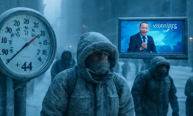
The first sign is not what you’d expect. Not the sting of air in your lungs, or the silent drift of breath turning to steam. It’s a sound. A faint, high whine threading through the dark winter sky—wind probing around window frames, testing the edges of the world for weakness. Somewhere far above that sound, beyond the clouds and the familiarity of jets and weather balloons, the polar vortex is beginning to falter. The cage of cold that usually stays locked around the Arctic is creaking, bending, and about to break in ways that could rewrite what we mean when we say “extreme cold.”
The River of Wind Above Our Heads
If you step outside on a clear January night and look up, you won’t see it. No shimmering outline, no swirling galaxy of ice: the polar vortex is invisible. It lives high in the stratosphere, roughly 15 to 50 kilometers above Earth’s surface, where the air is thin and dry and almost no clouds form. Up there, winter in the Northern Hemisphere summons a gigantic whirlpool of westerly winds, a cold crown spinning around the top of the planet.
Picture it as a colossal, high-altitude river of wind enclosing a reservoir of brutally cold air. When this river runs fast and tight—neatly wrapped around the Arctic—the cold mostly stays where it “belongs,” locked over the pole and frozen ocean. Cities in mid-latitudes still get their share of winter, but it’s the sort of winter that feels familiar: a few cold snaps, some snow, puddles that re-freeze overnight.
But the vortex is not a machine; it’s a living pattern of physics, sensitive to the whims of atmosphere and ocean. Some winters, pressure waves ripple upward from furious North Pacific storms or stubborn mountain ranges like the Himalaya and Rockies. These waves poke and prod the polar vortex from below, distorting its smooth circle into something wobbly and off-kilter—like a spinning top beginning to lose balance.
When that balance finally goes, meteorologists give it a name that sounds almost clinical: a “sudden stratospheric warming,” or SSW. In reality, it’s an atmospheric plot twist. Temperatures in the stratosphere above the pole can jump by 30 to 50 degrees Celsius in just a few days—not at the surface, but aloft, right where that once-stable ring of wind is turning to chaos. The vortex slows, splits, or simply collapses.
And when it collapses, the cold does not stay put.
The Day the Air Felt Like Glass
If you lived through the North American cold outbreak of January 2019, you might remember the way the cold stopped being an inconvenience and started feeling like a presence. In Chicago, the air temperature plunged below -30°C (-22°F). Mail service was suspended. Train tracks were set on fire—not as some dramatic ritual, but simply to keep the metal from contracting and buckling. In the early morning stillness, the air had that peculiar property of extreme cold: it felt almost solid, making each breath sting as if you were inhaling tiny glass splinters.
That cold wave was widely reported as a result of a disrupted polar vortex. But what’s forming above us now, say some meteorologists, could be larger, longer-lasting, and more geographically far-reaching. The phrase “historic magnitude” has been whispered in weather forums and research calls, but it doesn’t quite capture the real story. This isn’t just about what the thermometers will read. It’s about how our collective idea of “normal winter” might be cracking apart.
On the weather maps that scientists dissect each day, the signs are already forming: planetary waves bulging upward, the vortex stretching like taffy, pressures stacking in strange ways over the Arctic. Supercomputers chew on this data, spinning out hundreds of different futures. Many of these simulations are pointing toward the same unsettling outcome—an abrupt weakening or even a full-blown disruption of the polar vortex within weeks.
In most years, a vortex disruption means that somewhere—sometimes Europe, sometimes North America, sometimes vast stretches of Asia—will be dealt a hand of severe cold for at least a few weeks. But within the warp-speed climate of the 21st century, even an old phenomenon can behave in unfamiliar ways. Warmer oceans, reduced sea ice, shifting jet streams: all of this might be priming the atmosphere for a disruption of unusual strength.
When “Extreme” Has to Be Redefined
We toss around the phrase “extreme cold” easily—news anchors use it, headlines scream it—but meteorologists do have working definitions. Traditionally, an extreme cold event might mean temperatures falling into the lowest 1 or 2 percent of historical records for a given date and place, or wind chills that pose a near-immediate threat to exposed skin. These are the days when frostbite can set in within minutes, when even bundled-up commuters feel winter gnawing through their layers.
But what happens when the atmosphere outpaces the yardsticks we’ve been using? If model projections and early stratospheric signals are right, this coming disruption could push some regions well beyond the “once in a decade” or even “once in a generation” cold threshold. Think about records not just being nudged lower, but shattered—temperatures tumbling 15 to 25°C below seasonal norms for days or weeks.
Imagine a city used to mild winters suddenly staring down wind chills of -40°C. Imagine infrastructure designed for quick cold snaps having to contend with unrelenting deep freeze. Pipes that usually survive the occasional frosty night snap like brittle chalk. Roads heave and crack under thermal stress. Power lines sag with the weight of rime ice, the grid struggling to keep up as millions of heaters roar to life at once.
In meteorology, extremes are not just about the lowest number reached; they’re about persistence and scale. A brief plunge to -35°C is one kind of beast. Two weeks of relentless sub- -20°C, sprawling over continents, is another. What may be on the horizon is an outbreak that could redefine “extreme” not only by sheer cold, but by how long that cold sits on the landscape and how wide it spreads.
To understand how unusual that is, it helps to see how the polar vortex and its disruptions have played out in recent years.
| Event | Region Most Affected | Surface Impacts |
|---|---|---|
| Jan 2014 Disruption | Central & Eastern U.S., parts of Canada | Dangerous wind chills, power demand spikes, school and transport shutdowns |
| Jan 2019 Disruption | U.S. Midwest & Great Lakes, parts of Europe | Record lows, infrastructure damage, at least dozens of cold-related deaths |
| Jan–Feb 2021 Disruption | Central U.S., especially Texas; parts of Europe & Asia | Historic power outages, frozen gas infrastructure, extensive crop losses |
Now, researchers are watching the upper atmosphere and seeing hints that the next one may be comparable to, or stronger than, the most severe of these recent events. They’re asking, quietly but urgently: Are our definitions of “extreme cold” still large enough to hold what might be coming?
Listening to the Sky’s Early Warnings
There’s a curious delay built into polar vortex disruptions. The drama begins up high—in the rarefied, quiet stratosphere—then slowly leaks downward over weeks. It’s like watching a crack form in the ceiling and knowing, long before any plaster falls, that the damage will eventually reach the floor.
Meteorologists watch a cluster of signals: stratospheric temperatures over the pole spiking, wind speeds around 60 degrees north latitude weakening or even reversing, the once-round core of the vortex stretching into a lopsided oval or splitting into two distinct swirls. These features show up first in lines and colors on atmospheric cross-sections, long before they shape the wind pressing against your window.
But those signals matter, because they can alter the behavior of the jet stream—the fast-moving ribbon of air that steers storms and divides cold from warm. When the polar vortex falters, the jet stream can buckle southward, carving deep troughs that act like conveyor belts for Arctic air. One of those troughs might dig into North America, another into Europe, another into East Asia. In each case the same story plays out in slightly different accents: a day when the cold suddenly begins to feel heavy, intrusive, wrong.
At street level, though, these grand atmospheric maneuvers show up in mundane ways at first. A long grocery line as people “stock up, just in case.” The sudden, urgent hum of hardware stores as customers hunt for pipe insulation, space heaters, batteries. City crews checking salt supplies, revisiting emergency shelter plans, wondering how much of their budget will be frozen solid by midwinter.
Behind the scenes, climate scientists and forecasters are racing their own kind of clock. They’re trying to weave together how a warmer planet, a thinner Arctic sea-ice cap, and shifting ocean currents might be nudging these vortex disruptions into new territory. Some studies suggest a link between reduced sea ice and more frequent or intense mid-latitude cold outbreaks, while others find the relationship more tangled and region-specific. But almost no one believes we are heading into a future of gentle winters and easily predictable seasons.
Life at the Edge of Habitability
Walk down a city block on the first day of true Arctic air and you can feel the vulnerability of modern life. Batteries gasp. Tires harden. The sound of each footstep changes from soft thuds in slush to crisp squeaks on powder-dry snow. Engines growl reluctantly to life. People move differently, arms tucked in, shoulders hunched, conversations cut short by the need to cover faces and breathe through scarves.
In the countryside, the cold is even more absolute. Fences groan in their posts. Barn doors resist every attempt to move them. Water troughs turn to crystal, then to layered, stubborn ice that must be broken and cleared again and again. Under the soil, roots and seeds that evolved for harsh winters sit poised at the threshold of survivability, enduring temperature swings that press the limits of their genetic memory.
The coming polar vortex disruption, if it unfolds at the scale some expect, will be a test not just of meteorology but of everything built atop centuries of climate stability. Roads engineered for certain freeze-thaw cycles, buildings plumbed assuming only occasional hard freezes, power plants whose fuel and water lines were never designed to operate at -30°C or below for long—it’s this silent infrastructure that turns atmospheric anomalies into human crises.
Yet amid the anxiety, there is also a strange kind of awe. Stand in a field on a moonlit night at -25°C, the sky sharpened to razor clarity, the stars brutal and bright. Your breath crystallizes and hangs in the air. Any exposed skin begins to ache within seconds. You are, in a very direct way, meeting the raw physics of your own planet. This is Earth, unsoftened by central heating or double glazing. This is what it means to live on a world where air can lose most of its heat and still, somehow, support breathing creatures.
Our ancestors knew this viscerally. They timed their lives by the reliability of winter’s onset and retreat, by the depth of frost in the ground, by the sheen of ice on the river. Today many of us encounter true cold only as a temporary discomfort between warm spaces. A polar vortex disruption of historic magnitude has a way of stripping that illusion, reminding us how precariously we ride on the edge of habitability.
Preparing for a Cold We Haven’t Known Yet
So what do you do, down here at the surface, while the stratosphere reconfigures itself over the course of a few weeks? You can’t nudge the jet stream into a more polite shape. You can’t ask the polar vortex to hold firm a little longer over the Arctic. But you can prepare the fragile human systems that will soon be staring directly into the teeth of that cold.
On the smallest scale, it’s about layers—of clothing, of planning, of redundancy. Thick socks, insulated boots, gloves that let you keep using your hands. Checking that your home is as draft-proofed as it can be. Knowing where your shutoff valves are if pipes start to leak or burst. Making sure elderly neighbors have safe heating and someone to call if something fails. Remembering that in true Arctic air, cars need more than gasoline; they need care, time, and the right fluids to even start.
At the community level, it’s about resilience. City planners and utility managers may not be able to change the forecast, but they can study recent cold disasters—like the 2021 Texas freeze—to understand exactly where systems failed. Did gas lines freeze? Did power plants trip offline because their instruments iced over? Were there enough warming centers, and were people actually able to reach them? Extreme cold reveals weak points with ruthless clarity, but it also offers a blueprint for strengthening them.
On the scientific front, each major polar vortex disruption is a data-rich experiment delivered by the atmosphere itself. Researchers use these events to refine models, to test theories about how climate change may be bending the probabilities of such extremes. They trace the life story of a disruption from its first hints in stratospheric pressure graphs to the moment someone halfway around the world steps outside and says out loud, involuntarily, “This is the coldest I’ve ever felt.”
What makes this upcoming event so compelling—and unnerving—is the possibility that it will stretch the existing categories. Meteorologists may have to re-express what a “one-in-50-year” or “one-in-100-year” cold outbreak looks like in a climate that has shifted beneath those statistics. Insurance models will be recalculated. Building codes, in time, may be updated. Our relationship with winter itself will inch, degree by degree, toward something new.
Until then, the best we can do is pay attention—to the sky, to the forecasts, to the people around us who will be experiencing this same air in very different ways. Somewhere above the cloud tops, the polar vortex is rewriting the script. Down here, we are characters in a story still being drafted, waiting for the cold that could redefine what “extreme” truly means.
Frequently Asked Questions
What exactly is the polar vortex?
The polar vortex is a large-scale circulation of very cold air and strong westerly winds high in the stratosphere, centered over the Arctic (and a similar one over Antarctica in the Southern Hemisphere). It forms every winter and usually stays confined near the pole, acting like a lid that keeps the coldest air locked in the high latitudes.
What does it mean when the polar vortex is “disrupted”?
A disruption occurs when waves from the lower atmosphere disturb the polar vortex enough to weaken, displace, or even split it. This is often accompanied by a sudden stratospheric warming event, where temperatures high above the pole rise dramatically. After such a disruption, the jet stream can become wavier, allowing Arctic air to spill much farther south than usual.
Does a stronger polar vortex disruption always mean colder weather where I live?
Not always. A major disruption increases the odds of severe cold somewhere in the mid-latitudes, but it doesn’t guarantee it for every region. The exact location of the cold depends on how the jet stream patterns evolve. Some areas may experience extreme cold, while others might remain relatively mild or just see typical winter conditions.
How is climate change involved in polar vortex events?
The relationship is complex and still being studied. Some research suggests that Arctic warming and sea-ice loss may be linked to more frequent or intense polar vortex disruptions, which can lead to severe cold outbreaks in some regions. Other studies find weaker or more region-specific connections. What’s clear is that a warming climate does not eliminate cold extremes; it can, in some cases, reshape and intensify them.
How can I prepare for an extreme cold outbreak linked to a polar vortex disruption?
Preparation starts with reliable information: follow trusted local forecasts and heed any warnings. At home, insulate exposed pipes, check weatherstripping, and ensure you have safe heating options and backups. Keep extra warm clothing, blankets, food, water, and essential medications on hand. If you’re responsible for a business, farm, or facility, review cold-weather contingency plans well before temperatures begin to plunge.