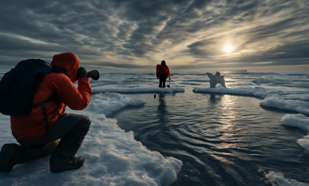
The cold came first as a feeling, not a number. A whisper at the window. A sharper edge to the wind sneaking under doors and around scarves. In late January, as most people were scrolling past weather apps and half-listening to nightly forecasts, something silent and ancient was stirring thousands of miles above our heads, in a ribbon of air most of us will never see, yet which shapes every winter of our lives.
Up there, near the edge of space, the polar vortex—the mighty ring of frigid air girdling the Arctic—had begun to wobble.
The Day the Sky Quietly Shifted
In a brightly lit forecast room in a city that could be anywhere—Boston, Berlin, Toronto, Oslo—a meteorologist leans closer to a glowing screen. The colors on the map are wrong. Or rather, they are right, but in a way that makes the stomach tighten. Deep plum and electric blue bleed southward from the pole, as if the Arctic itself has spilled across the hemisphere.
“That shouldn’t be there,” someone murmurs.
Across the world, in offices and research labs, versions of that sentence are repeated. Not panicked, not melodramatic—just flat, careful, unnervingly calm. For those who study the atmosphere, the new model runs are saying the same thing: early February could expose behavior from the Arctic we haven’t seen in decades.
What that means in human terms is both very simple and very complicated. It means cold, first of all—cold with a personality, a sharpness, a severity that rewrites what we thought winter meant in our lifetimes. It could mean snowstorms in places that haven’t seen real snow in years, while others shiver under crystalline skies and relentless, dry wind. It could mean ice thickening on rivers, brittle power lines snapping like matchsticks, and sea ice shifting in strange patterns far to the north.
But to understand why meteorologists are leaning in and lowering their voices, you have to start with the sky itself—layer by layer, like peeling back the atmosphere’s long, invisible skin.
The Polar Vortex: The Arctic’s Spinning Heart
The phrase “polar vortex” tends to live in headlines, shouted every few winters as if it’s a disaster that’s arrived on cue. In truth, the polar vortex is not an intruder at all. It is a fixture—an immense, swirling crown of cold air that sits high above the Arctic in the stratosphere, roughly 15 to 50 kilometers above Earth’s surface.
Most of the time, this vortex is a disciplined thing, spinning like a well-balanced top, keeping the bitterest cold locked up over the high latitudes. It’s the atmospheric equivalent of a fence, corralling the Arctic’s icy breath and preventing it from flooding south all at once.
But sometimes—just sometimes—this spinning crown wobbles, stretches, or even cracks into pieces. Those are the moments meteorologists watch for with a kind of hushed reverence, because when the vortex falters, winter on the ground can change character in ways that feel almost mythic.
Early this year, a signal emerged. High above the North Pole, temperatures in the stratosphere spiked abruptly—a “sudden stratospheric warming,” or SSW in the quiet shorthand of atmospheric scientists. It is a dry term for a profoundly dramatic event: roaring winds that usually spin west-to-east around the pole begin to slow, then reverse, like a great river flowing uphill. The polar vortex, once tight and symmetrical, starts to wobble and buckle.
From that point, it becomes a waiting game. What happens up there doesn’t immediately translate into snow in your backyard or frost on your living-room window. The atmosphere is a patient storyteller. It can take days or weeks for the disruption to “drip” downward into the layers of air we inhabit. But when that downward ripple does arrive, the world at ground level can tilt in uncanny ways.
When the Arctic Leaves Home
Imagine, for a moment, that the Arctic is a place not on a map but in the sky: a swirling archive of cold air, sealed away above the pole. When the polar vortex is strong, that archive stays mostly intact. The Arctic remains at home.
But in winters that people still talk about—1985, 1991, 2010, 2014—something else happened. The Arctic didn’t stay put. It came visiting.
The broken or stretched polar vortex sent lobes of cold southward like fingers. One lobe might slide over North America, freezing fountains in Texas and bending pine trees in Minnesota beneath the weight of impossible ice. Another might descend over Europe, locking rivers, stilling traffic, and turning usually mild towns into sudden outposts of a far-northern world.
That is what has meteorologists talking about “extreme Arctic behavior” this February: the possibility that the modern atmosphere is setting up a pattern reminiscent of those rare, brutal winters of previous decades, but in a world that has quietly warmed by about 1.2 degrees Celsius since those times. It is, in other words, an old story being retold on a hotter stage.
What Early February Might Really Feel Like
Forecasts are careful. The best of them are infused with humility. No one can say with certainty which town will be buried, which highway will glaze over, which coastline will see swirling snow where there used to be rain. But patterns, probabilities, and signals are all pointing in the same direction.
The first thing people will notice, if the models are correct, is a sense of suddenness. One week, the air feels merely sharp; the next, it bites. A light jacket that felt brave but doable on Monday is ridiculous by Thursday. Sidewalk puddles that refused to freeze through December’s lukewarm nights suddenly crystalize into opaque, stubborn ice.
In much of the mid-latitudes, especially across parts of North America, Europe, and northern Asia, early February could bring a cascade of impacts:
- Colder-than-normal temperatures for days or even weeks, rather than the brief cold snaps many regions have become accustomed to.
- Heavy snow in zones that have recently known only slush and chilly rain, straining cities that quietly lost their winter habits over milder years.
- Increased risk of ice storms, as layers of warm and cold air tangle above the surface, turning rain into a clear, armor-like glaze over everything it touches.
- Sharp pressure changes that whip coastal storms into stronger nor’easters or North Atlantic tempests, reshaping shorelines overnight.
On the human scale, this means small, tactile things: the metallic taste of air inhaled too fast; the crunch of snow that squeaks underfoot at subzero temperatures; the deep, quiet isolation that falls over a city when snow absorbs the familiar roar of traffic. It means hands fumbling with keys in thick gloves, breath hanging like ghosts in doorways, frost painting ephemeral ferns on windowpanes each night.
A World of Uneven Winters
Yet even as some regions brace for the icy reach of a distorted Arctic, others may experience the opposite: unseasonable warmth, rain instead of snow, or winter that feels like an afterthought. One of the strangest truths of a disrupted polar vortex is that it often creates contrast—deep cold in some places, startling mildness in others.
The atmosphere seeks balance, and in doing so, sometimes produces imbalance we can feel in our bones.
For farmers watching early buds swell on fruit trees, a February deep freeze following mild January days can be catastrophic. For migratory birds that took a warm spell as a sign to move, a late, brutal cold can rewrite survival odds. Even in the ocean, rapid shifts between cold and mild winters alter sea ice thickness, the timing of plankton blooms, and the journeys of creatures that follow them—krill, fish, whales, seabirds.
These are not just weather events; they are nudges to an interconnected web that has evolved under a certain choreography of seasons. When that choreography grows more erratic—when an Arctic pulse once expected once or twice in a generation becomes more frequent or more intense—the entire dance shifts.
Climate Change in a Winter Coat
It can seem like a contradiction: a world that is, on average, warming, and a forecast that warns of colder, harsher outbreaks in winter. Yet step outside on a subzero morning, frost crunching under lids of trash cans, and you are standing in the middle of that contradiction made real.
Scientists are careful not to blame any single cold spell directly on climate change. Weather is a moment; climate is a long, patient story. But, increasingly, research is pointing to a subtle relationship between a warming Arctic and a twitchier, more easily disrupted polar vortex.
The Arctic is heating faster than the rest of the planet—roughly four times as fast, by some estimates. Sea ice that once persisted into spring now breaks earlier. Open, dark water absorbs more sunlight and releases more heat back to the atmosphere, especially in autumn and early winter. Snow cover on surrounding continents forms later and melts earlier, reshaping how heat and moisture flow through the lower atmosphere.
All of this changes the “background music” the polar vortex spins to. Some studies suggest that years with less sea ice and altered snow patterns see more frequent or more extreme disruptions of the vortex. It’s as if the once-stable crown of cold has developed a nervous twitch.
That doesn’t mean every winter will be brutal. In fact, many regions are seeing overall milder winters, with fewer days of deep freeze and shorter snow seasons. But it does seem to mean that when the Arctic decides to lean south, it may do so in more dramatic, less predictable ways—especially in early February, when the stratosphere is most prone to these dramatic reorganizations.
| Pattern | What Usually Happens | What Early February Could Bring |
|---|---|---|
| Strong Polar Vortex | Cold locked near the Arctic, milder mid-latitudes | Fewer extremes, more stable winter patterns |
| Weak / Disturbed Vortex | Cold air lobes dip south only occasionally | Prolonged cold spells, heavy snow, sharp regional contrasts |
| Sudden Stratospheric Warming | Rare, once-in-years disruptions | Higher odds of extreme Arctic “outbreaks” in following weeks |
The Human Weather Inside All This
While maps glow and models hum, the real story unfolds in kitchens and bus stops and barns and power stations. An early February Arctic outbreak does not just live in charts; it lives in daily choices, in the quiet calculus of how to keep the cold where it belongs—outside the body, outside the bones.
Utility crews check inventories of transformers and salt. Cities rehearse their snow-plow choreography. School districts weigh remote-learning plans, remembering the patchwork of improvised classes during past storms. In many homes, people rummage through closets for heavy coats they haven’t needed much in recent years, or they realize, with a small jolt, that they may not have one at all.
For those without stable shelter, the phrase “extreme Arctic behavior” is not meteorological; it is existential. Outreach teams fan out with blankets, hot drinks, and offers of temporary beds. Public libraries stretch their hours, not as cultural institutions but as warming shelters. The invisible boundary between survivable and deadly cold narrows to a few degrees, a few hours, a few acts of community care or their absence.
On farms, animals huddle against barn walls. Heated waterers become small, essential miracles. In forests and fields, deer alter their feeding paths, birds puff themselves into comical spheres of feathers, and fox tracks appear where the snow—dry, squeaky, powder-fine—records every step like a diary no one meant to write.
Looking the Arctic in the Eye
To live through one of these winters is to be reminded, forcibly, that we share a planet with forces older and larger than our short memories. It is also, increasingly, to understand that we have become co-authors of how those forces unfold.
We have warmed the air that swirls above us, thinned the ice that once armoured the Arctic Ocean, and changed the timing of snow and rain. Now, in early February, when meteorologists issue quiet warnings about extreme Arctic behavior unseen in decades, we are glimpsing not just the might of nature but the intricate feedbacks of a climate we have helped destabilize.
Yet the story is not only one of threat. It is also one of clarity. The bitter cold makes visible what we often ignore: our dependence on one another, our vulnerability to power and transport and food systems we assume will always work, our intricate ties to landscapes we may only notice when they become hard to move through.
It is there in the neighbor who uses a snowblower to carve a path to an elderly person’s door; in the city crew working at 3 a.m. to keep pipes from bursting; in the farmer who leaves a light on in a barn as a promise to the animals that they have not been forgotten. It is there in the shared silence of people watching steely clouds gather, understanding that whatever comes next, they will go through it together under the same sky.
Weather as a Shared Language
When the Arctic leaves home, conversations shift. Complaints about the cold turn into stories: of the winter your grandparents remember, of the time a river froze so hard people walked across it, of the year school closed for a week and the city felt like an emptied-out stage set.
These stories are more than nostalgia. They are how we process risk, how we locate ourselves in the long memory of place. Meteorologists speak the language of jet streams and geopotential heights; most of us speak in “that winter when.” But the two languages are fused by something simple and enduring: the need to understand what is happening to the world we live in, and what that might mean for the days just ahead.
Early February may come and go in a rush of headlines and breathless weather alerts. Or it may etch itself into the narrative of a generation as “that winter when the Arctic came farther south than anyone could remember.” Either way, by watching the sky’s subtle shifts and listening to the people who study them, we can move from surprise to intention—from being caught off guard to being, at least in spirit, prepared.
Outside, the wind picks up. A stray leaf skitters across a crust of old snow, making a rasping sound like paper across stone. Somewhere far above, the polar vortex spins in a new, uneasy rhythm. And down here, beneath that restless crown of cold, we pull our coats a little tighter and step into the unfolding story of winter—awake, wary, and, in a strange way, more connected than ever to the distant, breathing Arctic that helped shape it.
FAQ
What exactly is the polar vortex?
The polar vortex is a large, persistent area of low pressure and cold air high in the stratosphere above the Arctic. It spins counterclockwise, usually keeping the coldest air confined near the pole. It isn’t a storm itself, but a major circulation pattern that influences winter weather across the Northern Hemisphere.
Why are meteorologists worried about early February?
Recent model runs and observations show signs of a disturbed polar vortex linked to a sudden stratospheric warming event. Historically, such disruptions can lead to outbreaks of Arctic air into mid-latitudes a few weeks later, producing severe cold spells and major snow or ice storms.
Does an extreme cold spell mean climate change isn’t real?
No. Climate change refers to long-term trends, not individual weather events. The planet is warming overall, but that can actually contribute to a more unstable polar vortex in some years, increasing the odds of dramatic cold outbreaks even as average temperatures rise.
Will every region experience extreme cold this February?
Not necessarily. A disrupted polar vortex often produces strong regional contrasts: some areas may see intense cold and snow, while others experience milder or wetter conditions. The exact pattern depends on how the jet stream and high- and low-pressure systems set up in the coming weeks.
How can individuals prepare for potential extreme Arctic outbreaks?
Preparation includes basic steps: checking home insulation, having backup heat sources where safe and possible, stocking essential supplies, making a plan for pets and livestock, and staying informed through reliable local forecasts and alerts. Community support—checking on neighbors, sharing resources—can be just as important as personal readiness.