The first hint that something unusual was happening didn’t arrive as a dramatic storm or a record-breaking freeze. It slipped in quietly, like a draft under a door. Forecast models began blinking with strange, swirling patterns 30 kilometers above our heads. Meteorologists stared at their screens, refreshed the data, frowned. In the thin, frigid air of the stratosphere, high above the altitude of cruising jets, the polar vortex—winter’s invisible engine—was beginning to buckle. And it was doing so early, and fast.
The Sky Above the Weather
Most of us experience winter from the ground up: the bite of air on our cheeks, the crunch of ice underfoot, the dull gray of a low ceiling of clouds. But the story of this winter’s next chapter is being written far higher than any snowflake can fall.
Up there, in the stratosphere—roughly 10 to 50 kilometers above Earth—the air is thin, cold, and usually calm in a very specific way. In winter, particularly over the Arctic, a vast cyclone known as the polar vortex spins like a ghostly top, trapping frigid air over the pole. Around it, winds howl west to east at more than 150 miles per hour. This swirling fortress of cold keeps the deepest Arctic chill more or less penned in.
But sometimes, something disturbs the fortress. Small ripples in the lower atmosphere—born from mountain ranges, massive storm systems, or disjointed jet streams—propagate upward like invisible waves. When these waves reach the stratosphere with enough punch, they crash into the polar vortex and begin to warp it. If they’re strong enough, they do something even more dramatic: they flip the script.
This is what scientists are watching now, as February unfolds. Temperatures in the stratosphere above the Arctic are rising not by a few degrees, but by tens of degrees Celsius within days or weeks. To us on the ground, “warming” sounds pleasant. In the stratosphere, it means upheaval. The event has a technical name—sudden stratospheric warming, or SSW—but behind the jargon is a simple idea: the machinery that drives winter is grinding, shuddering, and possibly reversing.
The Polar Vortex on the Rack
You’ve heard of the polar vortex before—usually as shorthand for brutal cold snaps. But the polar vortex itself is not a single storm or a one-off event. It’s a persistent structure of winds and cold air circling the Arctic every winter. Think of it as winter’s crown, spinning silently above the planet.
During a sudden stratospheric warming, this crown is tilted, cracked, or even split apart entirely. Strong atmospheric waves rising from below act like invisible hands grabbing the vortex and twisting. Within just a few days, stratospheric temperatures can climb by 30 to 50°C, even while the ground below still shivers.
When that happens, jet streams—a kind of high-altitude river of air—start meandering wildly. The vortex may weaken into a lopsided, wobbling oval, or tear into two smaller swirls that drift away from the pole. Where that cold air goes next is the part we care about: Europe, North America, or sometimes it stays corralling near the Arctic, reshuffling, without putting on a dramatic surface show.
What’s different now is timing and intensity. Sudden stratospheric warmings are not unheard of, but this one is early-season and appears unusually forceful. February is often a busy month for such events, but the patterns developing this year have a distinct sharpness—models hint at a powerful disruption, one capable of rewriting winter’s final chapters for millions of people.
How a Warming Event Changes Winter on the Ground
At first, nothing you can feel happens. The SSW unfolds miles overhead, almost abstract, detectable only in arrays of numbers and color-splotched model maps. Days might still be business-as-usual: chilly rain instead of snow, short afternoons, the occasional frosty morning.
Then, slowly, the gears connect. If the stratospheric disruption couples down into the troposphere—the layer where weather lives—pressure patterns rearrange like puzzle pieces. Blocking highs can set up over Greenland or the Arctic. The jet stream might buckle, digging deep south or arching unusually far north. Cold air that was imprisoned over the pole is suddenly given a passport and a destination.
For some regions, that can mean late-season cold snaps, blizzards that arrive just when spring catalogs show up in the mail, or a return to winter after a deceptively mild stretch. For others, it can mean the opposite: mild, wet, stormy weather as cold air vacates and warmer air surges in.
Scientists often talk about SSWs reshaping the “back half” of winter. That’s why forecasters are paying special attention right now. Seasonal outlooks drafted months ago—those color-coded maps suggesting warmer- or colder-than-average months ahead—suddenly look less certain. The atmosphere, in effect, is editing its own forecast.
Listening to the Scientists Watching the Sky
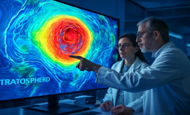
If you could step into a forecasting office this month, you’d find a strangely quiet kind of tension. No alarms, no flashing red lights, just the soft tap of keyboards and a clustering of scientists in front of screens. They are looking not just at familiar surface charts, but vertical slices of the atmosphere—temperature cross-sections, wind fields, wave diagnostics.
They’re searching for clues: How strong is the warming? How fast is the polar vortex weakening? Is it displacing—shifting off the pole—or outright splitting into fragments? Each scenario has different consequences for where the cold will go.
To make sense of this, think in terms of probabilities rather than guarantees. A strong sudden stratospheric warming stacks the deck toward certain outcomes, but it does not deal the exact cards. Historical analogs—past years with similar vortex disruptions—give hints, but never a perfect script.
Weather models simulate these possibilities over and over, like thousands of alternate timelines. In many of them now, the storyline is clear: the late winter pattern in the Northern Hemisphere will not simply glide through on autopilot. Something has changed at a structural level in the atmosphere, and the downstream ripples may last for weeks.
What This Could Mean for Your Weather
The natural question is: Will this mean more snow? More cold? Or, perhaps surprisingly, less?
There is no single answer, because the effects of an SSW are regional. But scientists have noticed some recurring themes when the stratosphere throws a tantrum:
- In parts of Europe, especially northern and western regions, SSWs often correlate with colder, blocked patterns. Arctic air spills south, and prolonged cold spells or snow events become more likely.
- In North America, the story is more nuanced. The eastern half of the continent often sees an increased risk of cold outbreaks, while parts of the western U.S. and Canada may end up milder or more stormy, depending on how the jet stream kinks and curls.
- In East Asia, powerful SSWs can help unlock cold surges, sending Siberian air pouring southward.
These are tendencies, not rules. One of the humbling realities of modern meteorology is that even with satellites, supercomputers, and decades of research, the atmosphere still refuses to be reduced to simple equations. But in broad strokes, a strong early-season SSW like the one taking shape is a clear message: do not trust the idea that winter is on a linear path from cold to spring. The story might yet twist.
| Region | Typical Effect After Strong SSW | Confidence Level |
|---|---|---|
| Northern & Western Europe | Higher chance of colder spells, increased risk of late-season snow | Moderate to high (based on past events) |
| Eastern United States & Eastern Canada | Increased likelihood of Arctic outbreaks and sharp cold snaps | Moderate (pattern depends on jet stream response) |
| Western North America | Can trend milder or stormier; cold air often displaced east | Low to moderate (high event-to-event variability) |
| East Asia | Greater risk of intense but sometimes brief cold surges | Moderate (linked to Siberian high pressure) |
| Arctic Region | Stratosphere warms, surface can trend milder as cold air is displaced south | High (directly tied to vortex disruption) |
Climate Change, Chaos, and the New Normal
Whenever the atmosphere behaves strangely, a question hangs in the air: is this climate change?
Sudden stratospheric warmings themselves are not new. Scientists have identified them in records going back many decades. They are a recognized, if dramatic, part of the natural variability of the winter climate system. Yet the background canvas on which they occur is changing.
The Arctic is warming more than twice as fast as the global average. Sea ice is shrinking and thinning, snow cover is shifting, and heat is leaking into the atmosphere from newly exposed ocean surfaces. All of this can influence how waves propagate upward into the stratosphere—those same waves that shove at the polar vortex.
Some studies suggest that a weakened, wavier polar jet—linked to Arctic amplification—might favor more frequent or more disruptive vortex events. Others caution that the relationships are complex, sometimes contradictory, and not yet nailed down. Climate models do not all agree on whether SSWs will become more common, less common, or simply different in character as the planet warms.
What most researchers do agree on is that extremes at both ends—warm and cold—can co-exist in a warming world. A warmer global average does not erase winter; instead, it can load the dice for sharper swings between mild and bitter, wet and frozen. An early, powerful stratospheric warming event fits this pattern: a dramatic rerouting of cold in a world where the baseline is steadily climbing.
Living Under a Restless Sky
For farmers planning when to start seeds, for city crews managing salt supplies, for wildlife trying to time migrations or hibernation, these shifts are more than academic. They ripple through daily life in ways both subtle and stark.
Imagine a region that has basked in an unusually gentle winter. Fruit trees are budding earlier; birds are singing in the hedges; people are leaving coats unzipped. Then, two or three weeks after a stratospheric shock, the jet stream plunges south. A mass of polar air arrives like a guest long forgotten. Temperatures dive. A heavy, wet snow coats blossoms not meant to bear that burden. The damage is not just an inconvenience—it can mean lost harvests, economic strain, and ecological stress.
Elsewhere, the reverse might unfold. Regions braced for their usual late-winter cold find instead a string of damp, mild weeks, swollen rivers, or slushy streets. The emotional rhythm of the season shifts too. Winter, once a more predictable character, now feels like a trickster.
That is, in a sense, what scientists are really tracking when they watch a sudden stratospheric warming unfold: the choreography of seasonal expectation and disruption. The rare early-season event taking shape now in February is a reminder that even the invisible realms of the atmosphere can tug directly on the fabric of our lives.
Why This Event Feels Different
Part of what has scientists talking now is not just that an SSW seems likely, but that it comes layered on top of other influential patterns—like El Niño in the Pacific or long-term Arctic trends. The atmosphere is a crowded stage this winter.
El Niño, for instance, typically redistributes heat and moisture around the globe, shaping storm tracks and jet streams. Add a major polar vortex disruption on top of that, and you have interference patterns—like overlapping waves in a pond. Some regions might find that El Niño’s expected signal is amplified; others might see it muted or scrambled altogether.
There’s also the calendar. An early-season SSW, especially one that looks powerful, has time to imprint on the rest of winter. Instead of a last-gasp event in late February that flickers into March, this kind of disruption can reshape weather for weeks at a point when many places still have plenty of winter fuel left in the tank—cold air, snowpack, and long nights.
From a forecasting standpoint, this is both challenge and opportunity. It is difficult because long-range outlooks must be updated, caveated, and re-communicated. Yet it is also a chance: SSWs, once underway, give seasonal forecasters a valuable piece of information. They know, with some confidence, that the deck has been reshuffled.
In living rooms far from the hum of forecasting centers, you might not feel that reshuffling yet. But somewhere above, in the still-strange blue of the stratosphere, the winds are reversing. The polar vortex is on the rack, twisted and weakened. Winter’s next move may already be set in motion.
FAQs: Early-Season Stratospheric Warming and Your Winter
What exactly is a sudden stratospheric warming (SSW)?
A sudden stratospheric warming is a rapid increase in temperatures in the stratosphere above the polar regions, typically by 30–50°C within a couple of weeks. It disrupts the polar vortex, the large-scale circulation of cold air and strong winds over the Arctic, and can eventually alter weather patterns closer to the ground.
Does an SSW always mean extreme cold where I live?
No. An SSW makes certain patterns more likely but does not guarantee specific outcomes for every location. Some regions may see colder, snowier conditions, while others may end up milder or stormier. The overall jet stream pattern determines where the displaced cold air travels.
How long after an SSW do we see impacts at the surface?
Surface impacts typically appear about 1–3 weeks after the peak of the stratospheric warming, if the disruption fully couples down into the troposphere. Sometimes the vortex is badly damaged aloft but the effects near the ground are muted or localized.
Are these events caused by climate change?
SSWs have occurred long before human-driven climate change and are part of natural atmospheric variability. However, the changing background climate—especially rapid Arctic warming—may be influencing how often they occur and how they behave. Research is ongoing, and there is not yet a clear consensus on long-term trends.
Can forecasts predict an SSW in advance?
Yes, modern weather and climate models can often predict the development of a major SSW one to three weeks ahead, sometimes more. However, predicting the exact surface impacts in different regions remains challenging, and forecasts are given in terms of probabilities rather than certainties.
What should people and planners do with this information?
For most individuals, it means staying tuned to updated local forecasts, especially if your region is prone to sharp cold spells or snow following SSWs. For planners—such as energy providers, transportation agencies, or farmers—it can be a cue to prepare for elevated risk of weather disruption in the weeks that follow.
Is this early-season event unusual?
Sudden stratospheric warmings are not rare, but the timing, strength, and combination with other climate patterns make this February event stand out. Its intensity and early development increase the potential to significantly reshape the remainder of the winter season in parts of the Northern Hemisphere.