The plane’s windows were blank white, as if someone had draped a sheet over the world. Below, Antarctica stretched in all directions—featureless, endless, impossible. At least, that’s how it looked. But the instruments inside the aircraft were quietly telling a different story. Radar pulses were slipping through the ice, bouncing off something hidden far below, returning as jagged lines and cryptic patterns on a screen. Somewhere beneath that still white surface, a landscape was waiting to be revealed—one that no human had ever seen, and one that would rewrite our mental map of the frozen continent.
A Continent That Isn’t What It Seems
We tend to imagine Antarctica as a simple thing: a huge slab of ice parked on the bottom of the planet. It’s tidy in our heads—white, flat, maybe a few mountains poking through. But if you could somehow drain all that ice away, pull a plug at the South Pole and let the frozen oceans of time pour out, you’d be left staring at a completely different world.
For decades, scientists have known that there are mountains and valleys under Antarctica’s ice, carved by ancient rivers and rebuilt by slow grinding glaciers. But the new work that has emerged in recent years—a detailed, high-resolution map built from ice-penetrating radar, satellite data, and patient, years-long modeling—shows that we’ve been dramatically underestimating the texture of that hidden land.
According to this new map, there are nearly twice as many hills and ridges under the Antarctic ice sheet as anyone thought before. And threading through this rugged terrain runs something astonishing: a giant valley, hundreds of kilometers long, that snakes through the darkness like a buried scar.
It’s as if a second, secret Antarctica has finally come into view—one that may hold clues to how the ice above it will behave as the planet warms.
The Sound of Ice Listening to Rock
To understand how this new map came to be, picture a small plane flying long, lonely tracks across the white. Inside, racks of equipment hum steadily. The ice-penetrating radar system fires pulses of radio waves downward, whispering through ice that can be more than three kilometers thick. Every time a pulse hits the base of the ice—where frozen water gives way to rock or mud—part of it bounces back, carrying information home.
On the screens, it doesn’t look much like a map at first. It’s a forest of lines, shifting densities of brightness, cryptic reflections. Each line represents a slice through the continent: the surface of the ice, the internal layers like tree rings frozen in cold time, and finally the bottom, where the radar signal hits rock or water and jumps back up.
Researchers spent years flying these lines, crisscrossing Antarctica in stubborn grids. Other teams added satellite gravity measurements, which reveal subtle changes in Earth’s gravity field caused by variations in the mass and density of what lies below. Still others used ice motion data from orbit, tracking how fast and in what direction glaciers creep and coast.
Then, in perhaps the most quietly dramatic part of the story, the data disappeared into computers. Mathematical models went to work—smoothing noise, reconciling conflicting measurements, blending old surveys with new flights. Slowly, the fuzzy underside of Antarctica sharpened into a picture.
The Moment the Map Snapped into Focus
When researchers first overlaid the new map on older versions, they didn’t just see more detail; they saw a different personality. Features that had been smudged and vague became crisp: ridges stood up like vertebrae along a spine; depressions resolved into networks of valleys; isolated bumps stretched into mountain ranges hidden under kilometers of silent ice.
The hills were everywhere. Small rises and mounds, broad undulations, sharper ridgelines—it seemed the bedrock of Antarctica was more rumpled, more complicated, more alive with topographic drama than earlier data had ever hinted. The new map suggested that the number of distinct hills and ridges was nearly double previous counts.
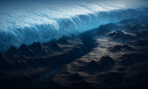
And then there was the valley. Not a tiny notch or a misplaced groove, but a deep, extensive trench that ran for hundreds of kilometers beneath the ice. In some places, its floor lay far below sea level. In others, it formed a long, low corridor between buried highlands—an ancient pathway sculpted by forces we’re only just beginning to piece together.
The Giant Valley That Sleeps Beneath the Ice
Imagine standing on a cliff, looking out over the Grand Canyon. Now cover the whole thing with several kilometers of ice, smoothing the surface into an unbroken white sheet, and you’re somewhere in the right emotional neighborhood. The newly mapped valley beneath Antarctica isn’t just long; it’s structurally important, a piece of the continent’s skeleton. Its dimensions—lengthy, sinuous, and in places startlingly deep—suggest a story that may stretch back tens of millions of years.
One leading idea is that this valley began as part of an ancient river system, a vast drainage network that once carried water across a greener, warmer Antarctica before ice conquered the land. Over geological time, tectonic forces could have deepened and widened the basin, while later glaciations scoured it repeatedly, sharpening and reshaping its slopes as enormous glaciers flowed along its path.
Now, the valley is more than a relic. It’s a structural guide for the modern ice sheet. Ice flows, after all, like very slow honey: it will always find the easiest path downhill. The valley provides such a path, channeling glaciers and ice streams in ways we’re only just beginning to quantify. Where the valley approaches the coast or connects to other deep basins, it may become a crucial route for ice to rush more quickly toward the ocean if the climate trigger is strong enough.
Why Valleys Under Ice Matter So Much
At first glance, it’s tempting to think of the bedrock under the ice as something static, something that just sits there while the real action happens above. But the truth is that the shape of the land beneath the ice can control how fast that ice moves, how stable it is, and whether it’s vulnerable to rapid collapse.
Deep valleys like this one can allow relatively warm ocean water—warm in polar terms, just a degree or two above freezing—to creep inland under floating ice shelves. If the valley’s floor lies below sea level and connects to coastal inlets, it becomes a hidden highway for heat. That heat can nibble away at the base of ice shelves, those broad, floating platforms that buttress the ice further inland. Remove or thin those shelves, and the land-based ice they hold back can accelerate toward the sea.
In a world where sea-level rise is one of the defining questions of the century, a buried valley under Antarctica is not simply a curiosity. It’s a clue to future coastlines, to the fate of cities, to the shape of human infrastructure in a warming world.
Twice as Many Hills, Twice as Many Clues
All those extra hills revealed by the new bedrock map might sound like a cartographic footnote—just more bumps on an already bumpy world. But each of those hills does something to the ice above it. They trip it, slow it, redirect it. They control where subglacial lakes pool and where water drains away. They determine which parts of the ice sheet are locked in place and which are primed to slide.
Think of a glacier’s base like a giant, icy sheet pulled over a rocky floor. Where the bed is flat and smooth, the ice can slip more easily, especially if there’s water at the interface. Where the bed bristles with hills and ridges, the ice is pinned, snagging on these buried high points, its movement broken into smaller, more complex patterns.
The newly revealed density of those hills helps scientists refine their models of ice flow. These models aren’t abstract—they feed directly into predictions of how Antarctica will respond to rising air and ocean temperatures. Every additional bump and valley that the models can “see” makes the simulated ice behave more like the real thing.
In practical terms, that means better forecasts. Will a certain glacier stay mostly stable this century, or could it speed up dramatically? How far inland might thinning reach if a coastal ice shelf weakens? The answers depend not only on temperatures and wind patterns, but on the rugged stage beneath the ice, where hills and valleys set the rules of motion.
| Feature | Old View | New Map Insight |
|---|---|---|
| Number of hills/ridges | Sparse, widely spaced features | Nearly twice as many, densely packed |
| Valleys | General depressions, poorly mapped | A giant, continuous valley traced in detail |
| Ice-flow modeling | Coarse, with large uncertainties | Higher resolution, more realistic behavior |
| Sea-level projections | Broad ranges, many unknowns | Tighter estimates, clearer risk zones |
The Invisible Sculptors: Water and Time
The map doesn’t only highlight static landforms; it hints at hidden pathways for something even more elusive: subglacial water. Under pressure, the bottom of the ice can melt slightly, especially where geothermal heat seeps up from Earth’s interior or where friction builds as ice grinds over rough ground. That meltwater flows downhill along slopes and valleys, collecting in lakes or weaving through labyrinthine drainage systems.
The newly mapped hills and giant valley act as gates and channels in this secret plumbing network. A small change in temperature might free more water at the base of the ice, which could then exploit these pathways, lubricating some regions while leaving others dry and locked. Over long spans of time, such shifts can reorganize entire ice streams, turning slow, stable ice into fast-moving conveyors of frozen mass.
In this way, the map is not just a static portrait. It’s a blueprint of potential futures, a guide to how and where the ice might decide to reorganize as pressures—both literal and climatic—change.
Seeing the Future in an Invisible Landscape
Why all this effort to chart something no one will ever walk across, no traveler will ever camp upon, no photographer will ever capture with a camera? The answer lies in what this unseen landscape controls, and how the fate of that control will spill out far beyond the Antarctic Circle.
Antarctica holds enough ice to raise global sea levels by nearly 60 meters if it were all to melt, which is not something that will happen in our lifetimes or those of our grandchildren. But the question is not “all or nothing”—it’s how much, how fast, and where. Will we see tens of centimeters, or multiple meters, of sea-level rise over the next few centuries? Will it come in a steady trickle, or in bursts tied to sudden structural changes in the ice sheet?
To answer that, scientists need to know not only how the atmosphere and ocean are changing, but how the ice will respond. And to know that, they need to know the ground beneath it. The twice-as-many hills and the giant valley aren’t just cartographic trivia; they’re the ligaments and tendons inside a system whose movements we need to predict.
At the same time, there’s something deeply human about the urge to fill in a blank space on the map. Antarctica is one of the last great frontiers of Earth, still withholding basic facts about its form. Every new radar line, every refined model, shaves away a bit of that ignorance. We’re not just protecting our coasts, in a way—we’re completing our picture of the planet we live on.
A New Kind of Exploration
The explorers of this age don’t plant flags on icy peaks; they debug code and pore over waveforms. Their “summits” are clean, internally consistent data sets; their “routes” are the intricate webs of flight lines and satellite paths that stitch a 3D world together from echoes and shadows.
Yet there’s still a romance to it. Somewhere in a lab, someone watched that valley come into focus for the first time—saw the contours coalesce, the depth reveal itself. They understood, in that quiet moment, that the Antarctica they carried in their mind had just flickered and reshaped itself into something grander and more complicated.
And that’s perhaps the most compelling part of this story: the realization that we are living at a time when even our own planet can still surprise us on scales that matter. That beneath the most forbidding ice on Earth lies a living landscape of hills and chasms, frozen rivers and ancient scars, waiting patiently for attention.
Questions Hidden in the Ice
The new map is not the final word on Antarctica’s underworld. It’s more like a high-resolution first draft—a detailed sketch that will be revised as more radar flight lines are flown, more satellites are launched, and new analytical techniques emerge.
Future work may reveal that the giant valley is even more complex than it now appears, branching into tributaries or connecting to other deep basins in ways we haven’t yet resolved. More subtle hills may emerge from the noise as methods improve. And entirely new kinds of features—collapsed basins, old fault scarps, remnant shorelines from long-vanished seas—could begin to stand out as we learn what to look for.
But already, this new chart of the invisible is forcing climate scientists, glaciologists, and oceanographers to rethink some of their assumptions. The ice sheet they’re modeling is no longer sliding over a vague, smoothed-out bed. It’s draped across a landscape full of traps and runways, dead ends and express lanes.
In this sense, every pixel of the new map is a question. How fast will ice flow here now that we know about this deep trough? Will that ridge protect an inland basin or simply slow inevitable retreat? If an ice shelf collapses along this portion of the coast, could warmer water exploit this valley to undercut the ice from far below?
We don’t know all the answers yet. But for the first time, we know where to look.
FAQ
Why do scientists map the land beneath Antarctica’s ice?
The shape of the bedrock controls how ice flows, where it melts, and how stable the ice sheet is. Accurate maps help improve models that predict future sea-level rise and how Antarctica will respond to climate change.
How can we “see” through kilometers of ice?
Researchers use ice-penetrating radar, which sends radio waves down through the ice. The waves reflect off the boundary between ice and rock or water, allowing scientists to measure the depth and shape of the surface below.
What is special about the newly discovered giant valley?
The valley is unusually long and deep, stretching hundreds of kilometers beneath the ice. It likely guides the flow of glaciers and could provide a pathway for relatively warm ocean water to move inland, affecting ice stability and potential sea-level rise.
Why does discovering more hills under the ice matter?
Hills and ridges act like anchors and obstacles for the ice above. Knowing where they are helps scientists understand which parts of the ice sheet are tightly grounded and which are more prone to faster flow or sudden changes.
Will this new map change sea-level rise predictions?
It doesn’t instantly rewrite all projections, but it does make models more realistic and precise. Over time, as the new data is integrated into simulations, it can refine estimates of how quickly and how much Antarctica might contribute to rising seas.
Can humans ever visit these hidden hills and the giant valley?
Not directly. They’re buried beneath up to several kilometers of ice, so we explore them remotely using radar, seismic surveys, and satellites. In some cases, scientists may drill through the ice to sample rock or water, but most of the “visiting” will remain virtual.
Is Antarctica still one of the least known places on Earth?
Yes. Even with modern tools, large regions remain poorly mapped, especially deep beneath the ice and under floating ice shelves. Each new survey adds crucial detail, but Antarctica still holds many geological and glaciological secrets.