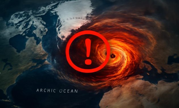
The cold arrived first as a rumor. A stray line in a forecast, a sharp blue tongue on a weather map shared late at night, a muttered warning from a meteorologist who’d been staring a little too long at the upper atmosphere. You might have scrolled past it, half-distracted, coffee in hand, the word “Arctic” blurring with “polar vortex” and all the other phrases that have drifted through winter headlines over the last decade. But this time, they’re saying, something is different. This time, the sky itself is slipping its usual script.
When the Sky’s Engine Falters
High above the clouds you know and the jet stream maps you see on TV, there is another river of air—a hidden engine that usually never enters our daily conversations. It’s called the polar vortex, a whirling crown of icy wind that spins around the North Pole, roughly 30 kilometers above our heads in a region of the atmosphere known as the stratosphere.
For most winters, that vortex behaves like a tight, disciplined dancer: circling, confined, keeping the coldest Arctic air penned up near the pole. It’s the quiet, orderly heart of winter itself, and when it hums along smoothly, our weather down here tends to follow familiar patterns. Storm tracks behave. Cold snaps come and go. Spring eventually arrives right on schedule, give or take a week.
This year, though, meteorologists watching the upper air charts began to see a subtle fracture in that order. Strange bulges of warmth began rising from the lower atmosphere, pressing up against the vortex like invisible hands. The stratosphere started to wobble. Then, in late January, the warnings sharpened: as February begins, a rare Arctic atmospheric breakdown is likely underway.
In the language of atmospheric science, it’s called a sudden stratospheric warming, or SSW—a tongue-twister phrase for a simple but astonishing event: the polar vortex, that great icy spin of air, can suddenly heat up by tens of degrees and break apart. For the people who study the sky, it’s as dramatic as watching a river turn backward.
The Soundless Crack You Can’t See
No sirens blare when the polar vortex begins to fail. You don’t feel the break itself. If you walked outside on the day the vortex fractures, you might just notice a normal winter sky—grey cloud, a faint wind, nose-stinging cold. The real drama is unfolding miles above you, in silence.
As waves of energy roll up from lower in the atmosphere, they start to slow and stretch the spinning vortex. Imagine a whirlpool in a river, someone pushing at its edge, then shoving harder, until the circle lengthens, distorts, and finally splits. Stratospheric temperatures rocket upward—sometimes by 30 or 40 degrees Celsius in a matter of days. That doesn’t mean tropical warmth at the North Pole; it means the icy stratosphere is suddenly less icy, and the carefully balanced winds collapse.
When that collapse happens, the vortex can do one of two things. It might simply shift off the pole like a drunken top, sending a long tongue of cold further south. Or it can crack into two or more smaller vortices, each wandering across the hemisphere like broken shards of glass, dragging Arctic air along with them. Meteorologists watch this closely, because what happens next is where your life, your heating bill, and your garden all get involved.
February’s Unfolding Wild Card
This winter’s warning isn’t just about a scientific curiosity at the edge of space. It’s about what that breakdown might do to the weather patterns you experience on the ground in early February and beyond. Often, it takes a couple of weeks for the chaos aloft to sink down through the layers of atmosphere and truly reorder the weather we feel. But once that shift arrives, the effects can be sharp, stubborn, and surprising.
If you remember the winter of 2018 in Europe, or the bone-deep cold that slammed parts of North America in 2014 and again in 2021, you’ve already met the echoes of a disrupted polar vortex. The public often lumps these events under the phrase “polar vortex,” imagining an Arctic hurricane disgorged onto city streets. The reality is a bit more subtle, but no less powerful: instead of spinning neatly in the far north, the cold is allowed to leak, spill, and settle far from home.
As February begins, meteorologists are tracking computer models that show a high-pressure dome likely to form over the Arctic, pushing cold air downward like a thumb on a balloon. In some scenarios, that displaced air surges into central and eastern North America. In others, it tilts toward Europe and parts of Asia, turning what had been a mild winter into a late and jolting freeze. Each model run rearranges the pieces like a kaleidoscope, producing different paths for the cold to follow.
There’s a humbling uncertainty embedded in this kind of forecast. We can see the breakdown; we can measure the warming high above, but the exact shape of what it will carve into our lives is still being drawn, hour by hour, by supercomputers spinning through trillions of possible futures.
How a Broken Vortex Feels in Your Backyard
Weather, in the end, is personal. It isn’t numbers on a chart; it’s the sting of the wind against your cheek, the heavy silence of snow before dawn, the frozen tap that won’t turn, the school closure alert pinging your phone. So what might this rare Arctic breakdown mean where you stand, coffee in hand, wondering whether you need your thickest coat next week?
What a stratospheric disruption often does is flip the usual script for a region. Places that have coasted through an easy winter can suddenly be dragged into a prolonged cold spell. Cities that saw flowers budding in January might watch them blacken under a surprise frost. The cold, when it comes, can be not only intense but persistent, lingering for weeks longer than climatology would suggest.
Elsewhere, especially farther south, the effect can be oddly reversed: while one continent shivers, another might sit under stubborn high pressure, basking in sun and unseasonable warmth. The atmosphere is a machine of balance; when you distort it in one place, it compensates in another. A broken Arctic ceiling may mean a bright, dry February for some and a grinding, icy ordeal for others.
To make this more concrete, imagine a handful of likely outcomes that meteorologists are weighing as the month begins:
| Possible Regional Impact | What It Might Feel Like | Everyday Effects |
|---|---|---|
| Northern & Central Europe | A sudden swing from grey, damp chill to sharp, snow-filled cold. | Travel disruptions, icy roads, late-season freezes for crops and gardens. |
| Eastern North America | Arctic outbreaks with biting wind, clear nights, and deep negative wind chills. | Spikes in heating demand, risk of frozen pipes, school closures, power grid stress. |
| Southern Europe & Mediterranean | Drier, sunnier spells, occasionally interrupted by cold snaps spilling south. | Water stress concerns, early blooms at risk if a late frost arrives. |
| Parts of Asia | Depending on the vortex split, anything from frigid outbreaks to blocked, hazy high-pressure stagnation. | Air quality issues under stagnant air, or heavy snow and cold if Arctic air plunges south. |
These are not certainties but sketches—outlines drawn in pencil that day-to-day forecasts will fill with color as February develops. The only thing meteorologists are close to sure of is that the background pattern has changed, and that change raises the odds of unusual weather.
The Long Memory of the Atmosphere
It’s tempting to treat this Arctic breakdown as a one-off oddity, a freak event that sweeps through the headlines, leaves some frozen pipes and spectacular icicles in its wake, and then vanishes. But the atmosphere has a long memory, and these stratospheric shocks sometimes echo far beyond their first cold snap.
Once the polar vortex has been kneecapped, it can take weeks—sometimes months—for it to fully recover its usual strength. During that time, the jet stream closer to the surface meanders more dramatically, like a river freed from its banks. That wandering can lock in weather patterns both cold and warm.
Over parts of the northern hemisphere, that might mean an extended period of northerly winds, drawing down chill after chill from higher latitudes. Elsewhere, it could anchor high pressure systems that keep rain away, drying out soils that should be replenishing before spring planting. The breakdown becomes not just an event but a backdrop, a rearranged stage on which all the smaller weather dramas of daily life play out.
There’s another layer too, quieter but more unsettling: the question of how these rare events fit into a world reshaped by climate change. Some studies have hinted that a rapidly warming Arctic, losing sea ice and snow cover, might be linked to more frequent or more intense disruptions of the polar vortex. The science is still debated, still full of caveats and ongoing research, but the broad picture is unnerving—a climate system nudged out of its old rhythms, occasionally stumbling in ways we feel as sudden, disruptive weather swings.
Living with Rare, Repeating Surprises
When meteorologists call this Arctic breakdown “rare,” they mean it in a statistical sense. Sudden stratospheric warmings large enough to truly upend winter patterns don’t happen every year. Historically, they’ve struck perhaps once every two winters on average, though not all have strong surface impacts. But from the vantage point of someone who can remember only a few decades of weather, even “occasionally” can feel like “again?”
Stories pile up: the winter when the river froze further than anyone could remember; the February when daffodils bloomed early only to be buried in a late snow; the week when your city’s pipes burst not from age but from a cold so deep it felt like another planet’s air had settled over town. These are how we log climate’s quirks in our own memory—through lived experience rather than statistical anomalies.
This February’s breakdown will write new weather stories like that. Somewhere, a child will see snow for the first time. Somewhere else, a farmer will scan a field for frost damage that wasn’t in the plan. In another town, a group of friends will walk out into a silent, transformed night and feel that rare hush after a heavy snowfall, the soft squeak of boots on fresh powder, the way city lights glow orange against low clouds. The same atmospheric physics that stresses power grids and shatters pipes also paints the winter landscape into something wild and beautiful.
Preparing for a Winter That Won’t Sit Still
So what do you do with a forecast like this—one full of rare atmospheric breakdowns and maybes and mights? This is where large-scale science meets the small, practical rituals of being ready: checking the weather more often, hunting for your thick gloves, making sure you know where the shutoff valve is for your water supply.
On the personal level, preparing for the impacts of a disrupted polar vortex looks a lot like preparing for any serious winter weather, with a little extra attention to duration. Because these post-breakdown patterns can linger, it helps to think not just about a single storm but about a stretch of challenging days or weeks.
That might mean:
- Insulating exposed pipes or leaving a trickle of water running during the coldest nights to reduce freeze risk.
- Checking that older neighbors or relatives have sufficient heating, blankets, and a way to get help if needed.
- Ensuring you have basic supplies—medications, non-perishable food, a flashlight with fresh batteries—if travel becomes difficult.
- Planning commutes and outdoor work with more flexibility; wind chills can turn short walks dangerous more quickly than expected.
- Protecting early-budding plants with coverings or bringing pots indoors if a hard frost is forecast after a mild spell.
For communities and infrastructure managers, these warnings are a nudge to stress-test systems: Are power grids ready for a spike in demand? Are road crews equipped for repeated snow or ice events? Are shelters and warming centers prepared to open quickly if temperatures plunge for vulnerable populations?
If there is a gift in the science of the polar vortex, it is this: the breakdown often announces itself well ahead of the worst ground-level impacts. You can’t do much about a storm that blooms over your head with only a day’s notice, but when the disruption begins above first, you sometimes get a week or two of lead time. That’s not enough to change the sky’s mind, but it is enough to set your own intentions about how you’ll meet what’s coming.
A Winter Sky Worth Listening To
Step outside one of these early February evenings and look up. The air might be still, the stars sharp, or a damp wind might be pushing low clouds across the streetlights. You won’t see the fractured vortex or the warmed stratosphere. But they are there, a reshuffling of high-altitude cards that will, in time, be played across your weather maps and windowpanes.
What meteorologists are telling us now—that February is set to begin under the shadow of a rare Arctic atmospheric breakdown—is less a single forecast than an invitation to pay attention. To notice how your particular patch of Earth responds. To feel how fragile and dynamic the systems are that we often treat as background noise.
Within a month, the headlines will likely move on. The vortex will heal, the stratosphere will cool, spring will advance in fits and starts. But for a little while, the planet is letting us watch, in slow motion, what happens when one of its great invisible gears slips a tooth. Somewhere between the science charts and the frost on your window, the story of this February is already being written in cold, light, wind, and memory.
Frequently Asked Questions
What exactly is an Arctic atmospheric breakdown?
An Arctic atmospheric breakdown usually refers to a major disruption of the polar vortex, often driven by a sudden stratospheric warming (SSW). The tightly spinning winds that normally trap cold air over the Arctic weaken or break apart, allowing frigid air to spill south into mid-latitudes and changing weather patterns for weeks.
Does a polar vortex breakdown always mean extreme cold where I live?
No. A breakdown increases the chance of unusual cold in some regions, but its exact impacts depend on how the jet stream and surface pressure patterns respond. Some areas may see severe cold and snow, while others might experience mild, dry, or even unusually warm conditions.
How soon after a sudden stratospheric warming do we feel the effects?
Typically, it takes about 1–3 weeks for the effects of a sudden stratospheric warming to propagate down from the stratosphere to the weather we experience at the surface. That’s why meteorologists can warn of heightened risk before the cold (or pattern changes) fully arrive.
Is climate change responsible for this rare breakdown?
The relationship is complex and still under active research. Some studies suggest that a warming Arctic and loss of sea ice may be linked to more frequent or intense disruptions of the polar vortex, but the scientific community has not reached full consensus. Climate change is altering background conditions, but it does not “cause” any single event on its own.
How can I best prepare for the potential impacts this February?
Follow local forecasts closely over the next few weeks, especially if meteorologists mention Arctic outbreaks or prolonged cold. Take simple steps: winterize your home and pipes, check on vulnerable people, have basic supplies on hand, and plan for possible travel disruptions. Being aware and prepared turns a rare atmospheric event into something you can face with more calm and resilience.