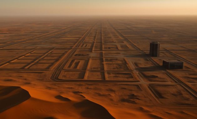
The first time you zoom in on it, the desert feels offended. On your screen, the sand of northwest Saudi Arabia is an endless, rippling sheet of beige and rust—lonely, wind-shaped, ancient. Then, as you scroll closer on the satellite map, a thin wound appears: a ruler-straight line carved across the emptiness. Zoom again. The line widens. You begin to see scars—access roads, graded earth, what looks like a raw, mechanical incision slicing through a landscape that once had no straight edges at all.
This is NEOM, and at its heart, the now-infamous project called The Line: a proposed 170-kilometer-long, mirrored megacity, a two-trillion-dollar bet that the future can be engineered out of glass, algorithms, and petro-wealth. On glossy promo videos, The Line is a floating sci‑fi dream: people gliding between hanging gardens and electric pods, vertical neighborhoods stacked like circuit boards, zero cars, zero streets, zero emissions. But from space, as construction stutters into reality, the dream looks very different—more incision than innovation, more extraction than Eden.
Satellite images don’t know how to lie. They simply witness. And what they’re beginning to witness in this patch of Arabian desert raises an unsettling question that hangs over the shimmering PR like desert dust: in a project this colossal, this intrusive, this expensive—who, exactly, is the future being built for?
The Desert Before the Line
If you strip away the branding and buzzwords, the place where NEOM now rises was once a quiet hinge of land between three worlds. This is Tabuk Province, brushing against the Red Sea, laced with wadis that swell with rare rains, dotted with shrubs that know how to survive on almost nothing. To the untrained eye, it’s just “empty desert.” To anyone who listens longer, it’s a living library of adaptation.
Satellite images from just a few years ago show a landscape of subtle textures: faint camel paths like pale threads across darker sand, ghostly riverbeds etched in gray, clusters of acacia trees huddled around unseen water veins. Light and shadow do most of the work here. Dunes undulate gently; rocky outcrops cast long afternoon silhouettes. There is no straight line—only curves, fractures, slow, organic drift.
Look closer and you notice something else: tiny geometric interruptions. Square enclosures. Lineated tracks. These are the fingerprints of Bedouin communities and small settlements like Sharma—modest farm plots, grazing routes, seasonal camps, and houses anchored to an old rhythm of rainfall and migration. For generations, people here built in conversation with the land, not in defiance of it.
Then, around 2021, the satellite record begins to change. A new geometry appears—bolder, brighter, more aggressive. Road grids cut sharply across the subtle desert palette. Work camps flare into view as white rectangles. Excavation sites open like wounds. The land is no longer just responding to wind and water; it’s being re-written by machinery.
The Scar that Shows Up from Space
The Line is designed to be only 200 meters wide but 170 kilometers long, bordered by mirrored walls rising 500 meters into the sky—higher than most skyscrapers in the world’s big cities. On a marketing deck, that sounds sleek, efficient, even elegant. On satellite imagery, it looks like a construction trench stretched to the horizon.
What you see now—if you zoom into recent high-resolution shots—is not a finished megacity but a colossal linear excavation, a gouge carved into sand and stone. Huge rectangles of disturbed earth mark where foundations will be poured. Earth-moving vehicles leave pale tracks that loop and curve but always return to that single, brutal line.
Surrounding the trench, temporary camps appear: clusters of prefabricated units in neat grids, often with their own parking lots and fences. From this distance, they resemble micro-cities spawning around a macro-city still in gestation. They are home, for now, to thousands of imported workers, the human machinery behind the machines.
To the west, other fragments of NEOM’s grand vision begin to speckle the imagery: port expansions, coastal developments, lines that hint at new roads lacing the shore. Each new piece means another bite out of the coastline, another rearrangement of where the sand stops and the sea begins. The desert, once an expanse of quiet continuity, now reads like a blueprint under revision.
It’s hard not to feel a vertigo of scale. Two trillion dollars. A city longer than some countries are wide. A mirrored wall so tall it will throw permanent shade across its own desert. Standing on the ground, it might feel surreal. From space, it already does.
Promises Written in Glass and Light
On paper—and in slick animated videos—The Line is a manifesto for a new human habitat. No cars, no streets, everything powered by renewable energy. Residents will travel end-to-end in 20 minutes on high-speed transit. AI systems will anticipate your needs. Nature will be “integrated.” Life will be, to quote the official language, “reimagined.”
There is a part of us, especially if we’ve sat in traffic breathing exhaust or watched coastal cities drown slowly, that wants to believe. A linear city that reduces sprawl, slashes commute times, and lives on clean power sounds like the kind of bold, moonshot thinking the climate era demands.
But satellite images add an uninvited footnote. To build this allegedly sustainable future city, an astonishing amount of unsustainable extraction is required in the present. You see enormous staging areas where rock is blasted and sorted, roads flung out into previously untouched terrain, and vast logistical chains of ships, trucks, and cranes etched into desert and harbor alike.
It raises a paradox that no amount of CGI greenery can fully obscure: can a city claim to be “zero emissions” if its birth requires such a massive surge of emissions, disruption, and displacement? Where, exactly, do you start the carbon accounting clock?
The official story is one of innovation and opportunity—hundreds of thousands of future jobs, cutting-edge technology hubs, a vision exportable to the world. But from above, the view is more ambiguous. You can’t see innovation on a satellite map. What you see are priorities made visible: what gets disturbed, what gets erased, and what gets lavishly invested in.
The People Missing from the Masterplan
There’s another kind of absence in the satellite record—one that doesn’t show up as pixels but as silence. Before NEOM, the region was not as empty as the glossy “untouched desert” narrative suggests. The Howeitat, a historically semi-nomadic tribe with deep roots in this land, grazed animals, built homes, and buried their dead here.
Reports from rights organizations and journalists have detailed forced evictions, demolished homes, and violent crackdowns on villagers who resisted relocation to make way for NEOM. Some activists from the Howeitat community now live in exile; others have reportedly been sentenced to harsh prison terms or even executed following protests. On satellite images, you can sometimes see the before-and-after: a cluster of homes in one frame and, months later, a clean-swept patch of bare earth.
The official narrative speaks of “relocation plans” and “fair compensation.” But there is no zoom level that will show you consent. There is no map layer that reveals whether the people who lived here asked for a mirrored city wall to bisect their homeland.
This is where the question of who benefits begins to sharpen. A two-trillion-dollar project doesn’t emerge from local need; it descends from national ambition and global capital. Crown Prince Mohammed bin Salman has framed NEOM as a cornerstone of Saudi Arabia’s post-oil future—a magnet for foreign investment, elite talent, and tourist dollars. It is a narrative about rebranding a country in one giant architectural gesture.
But for the families whose homes were bulldozed, for workers flown in to live in cramped compounds far from their own countries, the benefits are more elusive. The future is arriving, but not everyone gets to choose their role in it.
Who Owns a Two-Trillion-Dollar Future?
At the heart of NEOM lies a simple power equation. The project is wholly owned by the Saudi state, steered by a small circle of decision-makers, and sold to the world through a language of inclusivity and global citizenship. It speaks of “the future of all of us,” but the levers and land deeds belong to a very few.
Think of the numbers: two trillion dollars is a sum that can tilt global markets. It’s more than the GDP of many nations. That money flows from oil wealth—past carbon burned elsewhere, transformed into concrete, steel, glass, and data centers in this desert. The project promises new economic clusters: biotech, entertainment, advanced manufacturing, luxury tourism. Each cluster has its own winners in mind—venture capital funds, tech giants, real-estate developers, consultancies, high-net-worth residents looking for a gleaming bolt-hole in a warming world.
Ordinary Saudis are told they will see new jobs, better services, a diversified economy. Some surely will. But satellite imagery offers an unromantic view of where value is being created and extracted: prime coastal zones carved up for resorts; transport corridors rammed through previously public space; vast tracts effectively privatized under the banner of national transformation.
Imagine a future resident of The Line: perhaps a well-paid tech worker sipping coffee in a sky garden while drones deliver groceries. Then imagine the migrant laborer who helped pour the foundations, living miles away in a camp, sending remittances home, with little chance of ever standing inside the city whose walls he helped raise. Both exist in the same satellite image—the gleam and the grit—but only one appears in the marketing story.
To live in The Line, you will likely need the right passport, the right job, the right bank balance. To build it, you just need to be cheap enough and invisible enough to keep the machine moving. From above, the site is a choreography of these unequal roles, frozen into dirt and concrete.
The Visible and Invisible Costs
Satellite photos excel at surfaces: what’s built, what’s moved, what’s erased. But what they can’t show are the softer, slower costs—the strained aquifers that will have to feed a million residents in a hyper-arid region; the desalination plants churning brine back into the sea; the ecosystems that fragment quietly under a grid of lights, roads, and noise.
Still, they offer hints. You can already see the early outlines of water and power infrastructure radiating away from the core construction zone. You can see where the desert crust—formed over decades and centuries—is shattered by repeated vehicle tracks, leaving loose dust more easily lifted into the air. You can see new barriers—literal and metaphorical—between wildlife corridors, watering spots, and nesting grounds.
The environmental impact assessments, if fully released, would speak in charts and probabilities. The satellite record speaks in something more visceral: here is where the dune ridge once curved uninterrupted; here is where the line cut through.
There’s also a psychological cost that those pictures evoke. To look at a 170-kilometer engineered wall in the desert is to confront a very particular idea about human dominion—that in the face of climate crisis and inequality, the answer is not to scale back our reach, but to build bigger, shinier, more controlled environments, sealed from the chaos outside. It is a future premised on opting out, not on repairing what’s broken.
A City That Reflects—But What Back at Us?
The Line’s mirrored walls are designed to reflect the sky and sand, vanishing elegantly into the horizon. But step back to the satellite vantage point and the metaphor flips: this project reflects less the desert around it and more the global mindset that birthed it.
We live in an era where wealth pools at the top while the planet warms from the bottom up. Instead of grappling with the messy work of reform—more equitable economies, smaller footprints, slower growth—we are increasingly offered glossy escape hatches: privatized cities, climate-controlled enclaves, techno-utopias walled off from the storms.
NEOM is not alone in this. Across the world, mega-projects sprout in deserts, jungles, and seas—new capitals, artificial islands, “smart cities” boasting facial recognition and frictionless commerce. Each promises to be a laboratory for the future, but each also risks becoming a mirror that only reflects the priorities of its richest backers.
From orbit, they all look similar: bright, geometric impositions on landscapes that previously bent to geology, not to spreadsheets. The unsettling realization is that we are not just building new cities; we are editing the Earth for the benefit of a subset of its inhabitants, often without asking those who already live there.
Reading the Future from the Sky
In a way, satellite images have become the conscience of mega-projects like NEOM. They make secrecy harder, spin thinner. You can say that a village agreed to relocate; the before-and-after still shows the erasure. You can declare harmony with nature; the aerial view still records the scars. You can promise a future for “everyone”; the emerging pattern of walls, zones, and restricted corridors still hints at who will be kept out.
As The Line grows, the satellite record will become a kind of slow-motion documentary: month by month, kilometer by kilometer, we’ll see whether the vision holds or fractures, whether greenery actually takes root in the canyon of glass, whether transport systems materialize as promised or remain render-only fantasies.
We’ll also see something less easily measured: our own tolerance for this scale of experiment. Each new frame forces a question: at what point does ambition become hubris; at what point does innovation become enclosure?
Some will look at the images and see inevitability—a necessary leap if humanity is to unshackle itself from car-choked suburbs and fossil-fuel addiction. Others will see a misallocation of staggering resources, money that could have upgraded existing cities, adapted vulnerable communities, restored degraded ecosystems rather than overwriting a relatively intact one.
Either way, The Line ensures that the desert of northwest Saudi Arabia is no longer a quiet, anonymous place. It has become a global spectacle, a billboard visible from space.
Who Gets to Live Inside the Mirror?
In the end, the unsettling question that satellite images press upon us is disarmingly simple: when a country spends two trillion dollars drawing a new city into the sand, who gets invited inside the mirror—and who is left squinting at it from the heat outside?
The answer will not only be written in luxury brochures or government speeches; it will be inscribed in the shapes we can all see from above: where the worker camps sit in relation to the luxury districts, how public the public spaces really are, how many access roads lead in and how many security fences ring the perimeter.
From that height, you can’t read contracts or constitutions. But you can read patterns: concentration of wealth, flows of labor, footprints of extraction. In a decade or two, someone will drag a slider across time on a mapping app and watch the desert of Tabuk transform, frame by frame, from ripples of sand to a glittering, linear fortress. They will not see the meetings where it was approved, the protests where it was resisted, or the private conversations where doubts were swallowed.
They’ll only see the outcome and wonder, as we do now: in the race to build a future city, did we pause long enough to ask whose future was being built—and on whose land, with whose labor, at whose expense?
The satellites will keep watching either way. The question is whether we will.
Key Features and Concerns at a Glance
| Aspect | Official Vision | Emerging Reality from Satellite View |
|---|---|---|
| Project Cost | ≈ $2 trillion invested in a “city of the future” | Massive concentration of capital in a single region and model |
| Urban Form | 170 km linear city, compact, walkable, car-free | A vast linear trench and construction corridor scarring the desert |
| Environmental Claim | Zero cars, zero streets, 100% renewable energy | High up-front ecological disruption, heavy construction and logistics footprint |
| Local Communities | “Relocation” and new opportunities | Visible erasure of villages; reports of forced evictions and repression |
| Beneficiaries | Framed as a benefit for all Saudis and global citizens | Likely to favor state elites, investors, high-income residents over workers and displaced locals |
Frequently Asked Questions
What exactly is NEOM and The Line?
NEOM is a planned mega-region in northwest Saudi Arabia, envisioned as a hub for technology, tourism, and innovation. The Line is its flagship project: a proposed 170‑kilometer, 200‑meter-wide, mirrored city designed to house up to a million or more residents in a car-free, high-density linear corridor.
Why are satellite images important for understanding the project?
Satellite images provide an independent, time-stamped record of what is happening on the ground. They reveal the real scale of construction, land clearing, and infrastructure development, allowing outsiders to see beyond marketing materials and assess environmental impact, pace of work, and changes to existing communities and ecosystems.
Is The Line really environmentally sustainable?
The project is branded as zero-emission and fully powered by renewables, but its construction demands enormous material, energy, and land use. From an environmental perspective, this raises questions about lifecycle emissions, water use, habitat disruption, and whether building a new city from scratch in a fragile desert ecosystem is more sustainable than transforming existing urban areas.
What is happening to local communities in the NEOM area?
Human rights groups and journalists have reported that members of the Howeitat tribe and other local residents have been forcibly evicted or pressured to leave to make way for NEOM. Some who protested reportedly faced arrests, harsh sentences, or worse. Although authorities frame relocations as orderly and compensated, independent reports paint a much more troubling picture.
Who is likely to benefit most from NEOM and The Line?
The primary beneficiaries are likely to be the Saudi state, investors, major contractors, and future high-income residents or international businesses attracted to the project. Some jobs and opportunities may reach ordinary Saudis, but displaced locals and migrant workers who build the project are unlikely to enjoy the same long-term benefits or access to the high-end spaces they help create.
Can NEOM’s model be replicated elsewhere as a solution for climate change?
While some of its ideas—compact living, car-free design, renewable energy—are valuable, NEOM’s scale, cost, governance structure, and social impacts make it a problematic template. Many experts argue that retrofitting existing cities, strengthening public transit, and supporting community-led adaptation offer more equitable and scalable paths to climate resilience.
What should we watch for as the project develops?
Key indicators include the pace and pattern of construction visible from satellite imagery, transparency around environmental impacts and water use, treatment of local and migrant workers, actual accessibility for ordinary residents, and whether promised public benefits—including jobs, services, and open spaces—match the reality on the ground.